Quantcast
Channel: Explained Archives - Sometimes Interesting
Viewing all 97 articles
Browse latest View live

There Was Nothing in the World Like Action Park

$
0
0

Action_Park_Cover

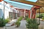
Action Park was one of the first water parks in the United States, and by the time it closed in 1996 it was the most dangerous. The park was a pioneer, not afraid to experiment with attractions in the quest for fun. Aggressive ad campaigns brought a million visitors per year and turned the northern New Jersey water park into a household name.

But a lax attitude toward safety eventually caught up with the owners. After 18 years of operation, a series of lawsuits stemming from injuries and deaths forced the park to close. This is a look-back at the classic water park and the wild attractions which made it famous.

*

Vernon_NJ_postcard

Off-season Ski Area

Action Park was the brainchild of Great American Recreation (GAR), owners of the Vernon Valley/Great Gorge ski area in New Jersey. In order to keep the turnstiles going in the summer, the company began offering seasonal attractions.

Action_Park_flyerIn 1977 an alpine slide was added to the mountain, which allowed riders to fly down the snow-free slopes on sleds controlled by nothing more than a hand brake.

The ride was immensely popular so park officials expanded the warm weather offerings the following year.

It was opened in 1978 as “Action Park,” featuring the new Waterworld attraction, one of the first water parks in America.

The park’s instant success pushed its owners to expand. In 1979 additional slides appeared, along with a deep-water swimming pool and a eventually a large wave pool. New attractions continued to appear every summer in the 1980s when Great American Recreation was experimenting with slide design.

Motorworld was the other major attraction, introduced later and built on unused land across Route 94. Park guests could unleash their inner Mario Andretti on a go-kart track, open wheel racers, or tanks.

Ultimately the park would grow into a major destination with approximately 75 different rides between the three major attraction areas.

[Jump to S-I index of Action Park attractions]

At its peak the water park overshadowed its ski resort sibling. Great American Recreation promoted Action Park with simple but effective TV commercials: Show people having a great time.

Action_Park_TV_commercial_logoCheesy era-appropriate jingles such as “There’s nothing in the world like Action Park!” and the ever-creative “The action never stops…at Action Park!” were kids’ rally-cries to their parents.

[Jump to S-I index of original Action Park TV ads]

Attendance grew each year as the crowds embraced the daring and unique attractions. If something looked like it might please the crowds, Great American Recreation was not afraid to try it.

Injuries to guests were common for multiple reasons, the most common being horseplay. Otherwise, it was a perfect storm for a disaster: Daring ride designs were poorly engineered and had little regard for safety. Under-trained teenage staff were often disinterested in enforcing safety guidelines, and alcohol was probably distributed a bit too freely.

After Action Park opened, doctors in four counties reported summertime increases in ankle sprains, broken bones, bloody elbows, and missing teeth.

Despite this, little action was taken by state regulators. Action Park was a great advertisement for the state, and a revenue generator. Most everyone was having such a great time, nobody wanted to disrupt it.

Action Park 1996 brochure (click to enlarge)

Action-Park-brochure-1996 Action-Park-brochure-1996-3 Action-Park-brochure-1996-2

*

Spotty Safety Record

Action_Park_Flyer_1995_BackSuch unrestrained freedom at the park came at a cost. Action Park was the site of several fatalities in just the first five years of operation. In 1980 a teenager died when his sled jumped off the Alpine Slide track.

In 1982 two visitors to the park died within a week of each other. When two more park visitors died in the summer of 1984, the park’s fortunes began to turn.

Lawsuits and a state investigation would slow growth and stop experimentation with rides, but attendance remained relatively strong.

By the mid-1980s, the park had developed a reputation for its unsafe rides. Rumors swirled of cut corners with maintenance and safety enforcement.

Friendly politicians and a lenient regulatory climate resulted in the park being fined only once in its first few years of operation, despite numerous citations for safety violations.

Despite these transgressions the park remained busy. It was one of a kind, and the most fun one could have for $24.95.

*

Action-Park-article-2

*

In 1987, the director of a nearby hospital’s Emergency Room admitted “five to ten” people were being brought in daily from the park. Reported injuries ran the gamut: Ankle sprains, broken bones, and cuts and contusions, dislocations, and concussions.

The park denied wrongdoing, but Great American Recreation purchased additional ambulances for the town of Vernon to keep up with the increased volume.

Action_Park_Map-1996Guests were not free of blame, however; many accidents were caused by the victims themselves. Injuries were often attributed to horseplay, hot-dogging, purposefully violating rules, or even just slipping while running.

A lack of rule enforcement encouraged frisky behavior and emboldened daredevils. Ride design catered to showmanship, with lines queued so that those waiting watched each person come down.

Still, there were enough cuts and broken bones from the water slides to raise red flags about the safety of the attractions.

Great American Recreation’s amusement park was often called Class Action Park,” “Traction Park,” or “Accident Park by the doctors and nurses who treated the wounded.

The doctors weren’t surprised when the injured arrived reeking of alcohol. Park alumni joke there were more beer kiosks than ice cream stands at Action Park.

*

Dark Side of the Action

Action_Park_drowning_articleOf course there were repercussions for having precarious safety standards. At least seven deaths have resulted from injuries sustained at Action Park, with countless others rumored

In an attempt to downplay the numbers, park representatives noted the park’s overall attendance made the injury and death rate “statistically insignificant.”

Below is a list of known deaths associated with the Park in any capacity – both direct and indirect. A handful of rumored (and unsubstantiated) deaths will not be included.

  • On July 8, 1980, a 19-year-old park employee died from injuries sustained while riding the Alpine Slide. A malfunction resulted in the sled failing to negotiate a turn. His head struck a rock, causing a fatal head injury; he died 8 days later.
  • On July 24, 1982, a 15-year-old boy reportedly drowned in the Tidal Wave Pool.
  • On August 1st, 1982, a 27-year-old man was electrocuted when he got out of his overturned kayak on the Kayak Experience to right it. He stepped on a grate exposed to live wire and was electrocuted. He was pronounced dead at the hospital.
  • In 1984 a visitor reportedly suffered a fatal heart attack, believed to have been caused by shock of cold water exposure in the pool beneath the Tarzan Swing. The pool was filled with natural spring water which could get up to 30 degrees colder than the water in the park’s other pools.
  • On July 28th, 1987, a 55 year-old man sustained a fractured hip in a water slide accident. He was thrown sideways into the pool at the end of the slide and collided with the concrete spillway at the edge of the pool. He died 3 weeks later from complications resulting from the accident.
  • On July 26th, 1992, six were killed and 47 injured when a bus traveling to Action Park on Route 515 overturned and burst into flames. This tragedy was not the fault of Great American Recreation and the deaths are not considered Action Park fatalities.

*

Beginning of the End

The lawsuits and settlements eventually caught up with Action Park. By the 1990s, Americans were spending less and insurance premiums were now suffocating the business. Years of negative headlines had eroded the park’s traffic.

The most dangerous rides disappeared first, closed as part of legal settlements or an inability to obtain insurance coverage. Ex-park employees have said Action Park operated without an in-force insurance policy for the last few years before closing.

Great American Recreation was forced into bankruptcy in 1995, but Action Park would quietly limp along for another year.

Action-Park-article-1When Action Park’s 1996 season ended on Labor Day (September 2nd), everyone expected it to re-open on Memorial Day weekend the following year.

But when the spring of 1997 rolled around, the park did not re-open. The park remained closed for weeks before officials would make an announcement. Whispers of a delayed opening in the summer never came to fruition.

It wasn’t until July of 1997 Great American Recreation officially announced the park’s closure.

*

Version 2.0

Less than a year later the property was sold to Intrawest, a Canadian destination resort developer. The company renovated the grounds and re-opened the property in 1998 as Mountain Creek Waterpark.

No doubt a throwback to the many original attractions the new park retained, Mountain Creek announced their opening with the slogan “The Action is Back!”

Overcoming Action Park’s decades-old stigma was a tall order, but Intrawest was a seasoned operator. Rides which could be made safer were modified; the others were closed. An emphasis was placed on training the staff and higher employment standards improved accountability.

Mountain_Creek_WaterparkAmong the casualties of the Mountain Creek conversion were the Alpine Slide and Motorworld. Most of the closed Action Park rides were replaced with newer, safer water slides.

The rejuvenated amusement park would enjoy a modest Renaissance at the turn of the century, but attendance tapered as the decade wore on.

In 2008 the park’s fortunes headed South with the economy, and its owners were eager to sell.

In 2010, the ownership of Mountain Creek ski area and Waterpark came full circle when it was sold to an investor group led by – of all people – Eugene Mulvihill, the former Great American Recreation executive who originally founded Action Park in the 1970s.

[Jump to S-I water park fun facts]

*

Conclusion

Water parks today benefit from a mature industry which has already learned from Action Park’s mistakes. Rides are largely cookie-cutter affairs, engineered with knowledge from over 40 years of ride failures baked-in. Appropriately, safety rules design today and the threat of litigation prevents risk takers. Action Park was from another era, and able try things that wouldn’t pass muster today.

The park was rough around the edges, but it was a pioneering concept created from scratch when there was no template. For 18 years the amusement park succeeded in its mission to entertain millions with its daring attractions.

For many it was a summertime ritual, like camp, scouts, or flag football. Thousands of Action Park veterans have permanent scars, viewed as badges of honor among the cognoscenti. If the standard was fond memories and good stories, Action Park set the bar.

Better than a tattoo? A scar from that time you almost died.

Action_Park_Waterslide

We did learn from our mistakes at Action Park. Following the lawsuits, New Jersey toughened regulations for amusement parks and safety standards increased.

Other changes were wide-ranging: Bi-lingual signs were now required and ride information was provided in metric for the first time. Alcohol sales were limited to specific areas and most importantly, rules were established and enforced.

Chris Gethard, writer for Weird NJ, summarized the Action Park experience well:

Action Park was a true rite of passage for any New Jerseyan of my generation. When I get to talking about it with other Jerseyans, we share stories as if we are veterans who served in combat together. I suspect that many of us may have come closest to death on some of those rides up in Vernon Valley. I consider it a true shame that future generations will never know the terror of proving their grit at New Jersey’s most dangerous amusement park.”

**

** Extras **

**

The Attractions

A summary of the major attractions throughout the life of Action Park:

Action_Park_AerodiumThe Aerodium: The first and only of its kind in the world, the German-designed Aerodium made its international debut at Action Park in 1987.

More or less a first-generation vertical wind tunnel, it could reach updraft speeds approaching 100 miles per hour.

Park goers would wear a special skydiving suit and “skydive” over an air column powered by a 650-horsepower fan. (picture at right courtesy Chris Collura)

Flights were less than a minute long and limited to a maximum of 6 or 7 feet (2 m) above the ground; the perimeter seating allowed family and friends to watch.

The Aerodium contributed it’s fair share of injuries to Action Park’s resume; broken arms, legs, and shoulder and wrist dislocations were not uncommon. An up-charge attraction (+$5), it closed in 1997.

Action_Park_Alpine_Slide Alpine Slide: In the Alpine Slide, riders sat on a plastic sled while navigating down the mountain in a concrete toboggan (watch a similar ride). It was tremendous fun but also incredibly dangerous, and would lead Action Park in firsts.

It was the first ride, completed in 1977. It was responsible for the park’s first death, in 1980. It was the first attraction to produce double-digit injury numbers on the grounds. In the early years it was first in number of safety violations and led the list of lawsuit-generating attractions.

(click to enlarge)

Action_Park_chairlift_Alpine_Slide-2 Action_Park_Alpine_Slide-2

The sled ran on a track which passed beneath the mountain’s chairlift system. On one occasion a park-goer thought it was a good idea to spit from the chairlift onto the Alpine Sliders below; then it became tradition.

Park-goers joked the sled had two speeds: “Snail in peanut butter” and “death awaits.” The sleds were not secured to the track and frequently went flying.

The temptation of impressing those watching from the chairlift – and dodging saliva bombs – reinforced rambunctious behavior and a relaxed attitude toward safety.

Action_Park_Alpine_Slide_warning_evan_solomon

courtesy Evan Solomon

It was closed in September of 1998 after being open for one season under the new Mountain Creek Resort. The ride was later modified and re-opened as an Alpine Coaster, a hybrid alpine slide/roller coaster.

Aqua Scoot: This attraction featured several chutes with warehouse-like rollers. Riders would descend the steep slides on plastic sleds, eventually landing in a shallow pool. (pictured below)

The attraction’s designers intended for riders to skip across the water like a flat stone, but reality seldom echoed intention at Action Park.

Balance was key; if the rider didn’t remain upright, they were likely to be flung from the sled upon contact with the water. Many visitors did this by design, but the hard concrete floor was 2 feet away and waiting to punish daredevils.

Action_Park_Aqua_Scoot-2 Action_Park_Aqua_Scoot-1

Aqua Scoot photos courtesy Chris Collura

The dangers weren’t limited to those who engaged in horseplay; riders leaving the pool still had to dodge those exiting the chutes at high rates of speed.

Bungee Tower: In the park’s later years a 120-ft (36m) tall bungee tower was constructed near the Alpine Slide.

The “Whipper Snapper” debuted in 1991 as an up-charge attraction; guests could pay $5 in addition to the park entry fee to ride. Bungee riders had to be at least 16 years old, 54 inches tall, and weigh at least 110 pounds. Cords were issued corresponding to weight ensuring every rider enjoyed the same “bounce.”

The bungee tower eventually closed with Action Park in 1996.

Action_Park_Cannonball_Falls

Cannonball Falls: In the Cannonball Falls, park guests could descend one of two dark, covered slides before being deposited 10 feet (3m) over a deep pool filled with natural spring water. The spring water could reach temperatures up to 30 degrees colder than other park pools.

 Cannonball Loop: The infamous Cannonball Loop (pictured below) was the park’s biggest failed attraction, but it’s sheer audacity in concept has given it legendary status in amusement park lore.  At the time, Great American Recreation was experimenting with new attractions.

At Action Park, attraction experimentation sometimes meant abandoning convention. In the case study of the Cannonball Loop, the convention which was abandoned appeared to be physics.

According to former employees, an expert from Switzerland was brought in to develop a radical new waterslide design.

Action_Park_Cannonball_Loop

The design was extreme and bordered on the fantasy. Testing did not go well. Dummies exited the pipe missing limbs; one came out in two pieces. If there was suspicion of poor design, it was confirmed when a hatch had to later be added to the loop to remove riders who got stuck.

Debris and rocks would collect at the bottom of the loop, creating a sandpaper-like surface. Those who dared make the plunge suffered terrible cases of slide rash. Employees were offered $100 to test the outlandish slide, but few dared accept the offer.

Said one employee who gave it a go: “$100 did not buy enough booze to drown out that memory.”

Action_Park_Cannonball_Loop-3 Action_Park_Cannonball_Loop_2 Action_Park_Cannonball_Loop_3

photos courtesy domainofdeath3.com

The Cannonball Loop was ridiculous and everyone knew it. Those daring enough to try the slide left with scars, which ironically served as an informal ranking system among the regular park-goers. It lasted for a month in 1985 before the state’s Advisory Board on Carnival Amusement Ride Safety ordered it closed.

For the next eleven years it was abandoned near the entrance of Waterworld. Shortly after Action Park closed it was dismantled and never rebuilt.

Action_Park_Colorado_RiverColorado River Ride: A circular raft ride, the Colorado River was a long and winding concrete trough fashioned to look like a natural river. Opened in 1987, it was billed as a family ride by Action Park – yet the trip was bumpy and sometimes violent. (pictured at right)

A group of riders could share a raft down the Colorado, which would throw riders against rocks in corners and at points descends into a tunnel.

Protruding rocks would tag unsecured riders who could not see in the darkness; concussions were common.

The Colorado River Ride is still open at Mountain Creek today (video), although helmets have wisely been introduced since the Action Park days.
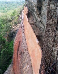
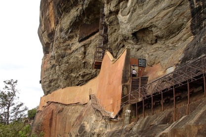
The Diving Cliffs: Near the Roaring Springs were a pair of diving platforms, artificially constructed to appear as natural cliffs in a tropical, grotto-like environment. The platforms were 23 feet (7m) and 18 feet (5.4m) above ground level; the large man-made pool was built to appear as natural and reached 16 feet (5m) deep at its lowest point. (pictured below)

The swimmers, cliff jumpers, and those exiting water slides created congestion in the pool, which kept the lifeguards busy. More than a few almost drowned; one park employee shared: “The bottom of the pool was eventually painted white to make it easier to spot any bodies on the bottom.” The diving platforms are open at Mountain Creek today as the Canyon Cliffs.

(click thumbnails to enlarge)

Action_Park_Diving_Cliffs-3 Action_Park_Diving_Cliffs-2 Action_Park_Diving_Cliffs

 Gladiator Challenge: The Gladiator Challenge was opened in 1992 and based on the TV series American Gladiators. Park visitors would compete against each other in a jousting match or through an obstacle course.

The attraction was designed and operated by former bodybuilders who scoured local gyms for talent. It was removed in 1995 and replaced with the beach volleyball court.

Grass_skier Grass Skiing: Few attraction names describe the ride better than Grass Skiing. Under a chairlift on the beginner and intermediate slopes of the mountain, patrons could “ski” downhill over grass on wheeled skis not dissimilar to roller-blades.

While fun, it requires skill and is not ideal for the novice.

It ultimately proved too dangerous for the typical inebriated park-goer; a rash of injuries followed the launching of the attraction. It was abandoned after one season.

Kamikaze: This was another landmark attraction at Action Park and one of the few original attractions to survive the conversion to Mountain Creek Resort in 1998.

The Kamikaze was a pair of 4-story tall speed slides which would send dueling riders down chutes at high speeds into a small pool at the bottom.

After nearly 30 years of service, the Kamikaze was eventually dismantled after the 2009 season. Park staff shared the reasons off-the-record: An increasing occurrence of injuries – the latest allegedly being a broken neck.

The Kayak Experience: This attraction was a mock whitewater course which used submerged electric fans to agitate the water, creating a faux rapids.  It was also one of the first attractions to be closed at Action Park. Kayaks would frequently get stuck or tip over, spilling the person into the river – which can be deadly if a live wire is exposed underwater.

This happened to a park-goer in 1982; he was electrocuted and died. The ride was immediately closed, and a spokesperson for the park explained: “Action Park will close this ride because people will always be intimidated by it.

Action_Park_Motorworld_speedwayMotorworld: On the west side of Route 94 was a separate section of the grounds known as Motorworld. This driver-themed amusement park had several attractions.

The Super Go Karts were gas-powered karts driven around a small, paved loop. They had speed governors limiting them to 20 mph, but these were easily circumvented with a tennis ball.

The LOLA cars (pictured at right) were miniature versions of the professional race car and a step up from the Super Go Karts. An open cockpit design and a longer track allowed the LOLAs – which also had a defeatable governor – to achieve greater speeds.

The most popular ride was arguably the Tank Ride, miniature tanks equipped with cannons capable of firing tennis-balls at each other. If a tank’s sensor was struck, the vehicle would stop for 15 seconds.

Action_Park_4wheelingUltimately patrons favored targeting the staff, finding more joy in beaning the pour soul trying to rescue stalled tanks rather than disable an opponent.

Watercraft also featured in Motorworld with both Super Speedboats and Bumper Boats. While neither could be modified for higher speeds, frequent inebriation during their use resulted in several accidents.

Motorworld was closed with the rest of Action Park in 1996 and has since been replaced with a housing development, restaurant, and additional parking for the Mountain Creek ski resort.

Roaring Springs:  This is a raft-based whitewater ride with two options: Single-tube riders went down the Gauley (video) on the left; double-tube riders used Thunder Run (video) on the right.

As did every other Action Park attraction, the Roaring Springs had a blotter.

Action_Park_Roaring_Springs-3-Thunder-Run

Thunder Run

Fractured collar bones, femurs, and noses appeared in the park’s 1984 filings to the state. Also included: Broken elbows and several dislocated knees and shoulders. Sadly this isn’t enough to place the Roaring Springs in the top five at Action Park in injuries.

The rapids closed with Action Park in 1996 but were re-opened by Mountain Creek two years later.

Action_Park_Roaring_Springs Action_Park_Roaring_Springs-2-Gauley

The Gauley (courtesy Johnny Pluckman)

The Roaring Springs remained open until 2005, when Mountain Creek closed the ride due to a high number of injuries.

Action_Park_Sling_ShotThird time’s a charm, or strike out? Mountain Creek re-opened the rapids in 2012, and within months it dealt another rash of injuries to riders. Six were injured and one woman almost drowned.

Sling Shot: Two riders are flanked by large bungee cords and flung into the air (pictured at right). It was also an “up-charge” attraction requiring riders to pay an additional $5.

Up-charge attractions were usually a result of required additional insurance coverage for the park operator. The increased operating costs drove the additional fee.

The Sling Shot was opened in 1993 and would close two years later in 1995. (video of similar ride at Six Flags)

Action_Park_Space_Shot-brochureSkate Park: One of the shortest-lived attractions, the poorly-planned skateboard park was a nightmare and lasted all of one season. Crudely-poured pavement had uneven lines and gaps between joints.

A former park employee recalled “the skate park was responsible for so many injuries, we covered it up with dirt and pretended it never existed.”

Space Shot: This ride shot passengers 200-feet (61m) in the air before allowing gravity to drop them in a free fall (pictured at right).

Copies are common in amusement parks today, the Space Shot ride lived beyond the Action Park era and wasn’t closed until the Mountain Creek years.

It was reportedly sold after the end of the 1998 season. (video of similar attraction)

Super Speed Water Slides: Affectionately known as Geronimo Falls, these super chutes had near-vertical slopes allowing riders to attain high speeds before slowing into small pools at the bottom.

Despite being one of the more dangerous attractions, the Super Speed Slides ironically reported one of the lower injury rates of the Action Park attractions – although admittedly that standard may not have been very high.

The original slides are gone, eventually replaced by a single 99-foot slide known as the H2-Oh-No (video).

Action_Park_slides

Surf Hill: This was the blue, large, multi-lane hump slide common to many water parks today. Park visitors would ride on mats head-first down a slide built into the side of the mountain. At the end of the slide were small pools meant to slow riders.

An eighth lane offered a special jump allowing riders to “show off” in front of others; it was nicknamed the Back Breaker.

Action Park’s Surf Hill (courtesy Chris Collura)

As expected, horseplay was common and usually the genesis of injuries. Minimal barriers between lanes resulted in riders crashing into each other on the way down; typical souvenirs consisted of bruised elbows and forearms.

Surf Hill was closed by Mountain Creek in 2005 before being reopened in 2012.

OLYMPUS DIGITAL CAMERATarzan Swing: A natural spring ran through Action Park. Great American Recreation created a pool fed by the (cold!) fresh spring water for the Tarzan Swing attraction. (pictured at right)

Visitors could swing from 20 ft-long (6.1m) cables suspended by a large steel beam arching over a man-made pool fashioned as natural jungle habitat. (video)

Park officials likely didn’t envision visitors shouting loud strings of obscenities when they drew up this attraction, but that’s exactly the soundtrack which accompanied most jumps.

During peak days in the summer, staff reported the ride had turned into a competition among the park-goers to see who could set the bar the lowest. Rude words, single-finger gestures, and the occasional garment removal were not uncommon.

The attraction evolved over the years as park officials dealt with injuries. Riders scraped knuckles, skinned knees, and broke toes. Cushions were added and launching platforms moved forward.

Tarzan Swing (courtesy WeirdNJ.com)

Tarzan Swing (courtesy WeirdNJ.com)

But it wasn’t the bumps and bruises which would permanently scar the Tarzan Swing; the frigid spring water could temporarily stun visitors. Cold water can shock the muscles, preventing basic motor functionality – and swimming.

In the most extreme cases, cold water shock can cause cardiac arrest. In 1984 an Action Park visitor reportedly died from a heart attack believed to be caused from the shock of landing in the spring pool.

Tidal Wave Pool: The largest and deadliest attraction at Action Park, the “Grave Pool,” was 100 feet (30m) wide by 250 feet (76m) long. The massive freshwater pool reached 8 feet deep and was reportedly able to accommodate up to 1,000 people. Twelve lifeguards were on duty at all times.

Waves over 3 feet tall were generated in 20-minute sessions and spread between 10-minute intervals. Twelve lifeguards kept watch over the Tidal Wave Pool, and on the busiest weekends they were known to rescue as many as 30 people.

Action-Park-Wavepool

Action Park Tidal Wave Pool (courtesy WeirdNJ.com)

A big problem was that many of the wave pool’s users were just not good swimmers. A park official explained the matter with diplomacy: “Action Park attracts many people from urban areas who have few chances to swim and frequently must be rescued from the water. They don’t know how to swim and jump right into the water.”

The fresh water was not as buoyant as the salt water of the ocean, so park goers would have to work harder to stay afloat. Crowded swimming conditions resulted in people colliding into each other – or the ladders – as they tried to get out of the frenzy.

*

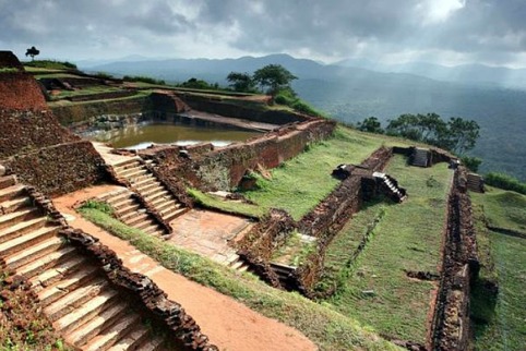
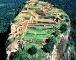
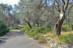
For the Cartographers

While Action Park is no more, Mountain Creek Waterpark still uses a handful of the original rides today. Some of the defunct Action Park fossils are also still visible. Check out the resort in Google Maps (or Bing Maps, if that’s your preference).

Users on Wikimapia have done a great job mapping the rides in Mountain Creek. The image below is from this page, which breaks down each ride’s location in detail.

Action_Park_Wikimapia

*

Water Park Fun Facts

There are more than 1200 water parks in North America. The rest of the world has around 720.

 The oldest water ride in operation is the Old Mill in Kennywood Park, Pittsburgh. The Pennsylvania mill ride was opened in 1901 and has been remodeled under several different themes during its life.

The first official water park in the United States was Wet ‘n Wild in Orlando. SeaWorld creator George Millay founded the park in 1977.

The first indoor water park was World Waterpark, opened in Canada in 1986. The Edmonton, Alberta facility is the second-largest indoor water park in the world today.

The largest indoor water park in the world today is Tropical Islands Resort in Germany (pictured below). A converted airship hangar, it covers an area of 710,000 square feet (66,000 sq m).

Bali Pavilion, Tropical Islands, Germany

Bali Pavilion inside converted airship hanger Tropical Islands Water Park

With five indoor water parks, Wisconsin Dells, Wisconsin is known today as the “Water Park Capital of the World.” Noah’s Ark Water Park is also the largest in the United States with 51 water slides.

The largest indoor water park in the UK was opened in 1986. The Sandcastle Water Park is located in Blackpool

In London, the Croydon Water Palace was opened in 1990, however financial difficulties closed it in 1996.

In Moscow, Russia, Transvaal Park was closed in 2004 after the roof collapsed and killed 28 people.

The tallest & fastest free-fall waterslide in the U.S. is Summit Plummet at Disney World in Lake Buena Vista, Florida. Riders hit 60 mph (97 km/h) and at 120 feet (37m) high, it’s the 3rd tallest in the world.

The 2nd-tallest water slide in the world is as tall as a 14-story building. Insano at Beach Park, Brazil, is actually the tallest freestanding water slide in the world at 135 feet (41m) tall; riders can hit speeds of 65 mph (105 km/h). (POV video)

The current record-holder as tallest water slide in the world belongs to Kilimanjaro in Barra do Pirai, Brazil. However it is not a freestanding structure; the 164 feet (50m) drop comes by way of a slide installed on the side of a large hill. (pictured below)

Kilimanjaro_water_slide

 The future record holder as tallest water slide will be Verrückt in Kansas City’s Schlitterbahn Water Park. The new slide will have two drops and is taller than Niagara Falls (however it appears unlikely passengers will go down in a barrel).

Verrückt is expected to open in May of 2014. Here’s the promotional video – and it does look insane, so it will make sense to Germans:

 The largest outdoor wave pool in the world today is Talay Krung Thep, part of the Siam Park City theme park in Bangkok, Thailand. It’s a pretty sight on the map but is apparently no longer very popular.

 New water parks are opened every week around the world. By the time you finish reading this, most of the superlative information above will be outdated.

 Top 10 Water parks in the world by attendance:

  1. Typhoon Lagoon (2,100,000), Walt Disney World, Orlando, FL
  2. Chimelong Water Park (2,021,000), Guangzhou, China
  3. Blizzard Beach (1,929,000), Walt Disney World, Orlando, FL
  4. Ocean World (1,72,000), Gangwon-Do, South Korea
  5. Aquatica (1,538,000), Orlando, FL
  6. Caribbean Bay (1,508,000), Gyeonggi-Do, South Korea
  7. Aquaventure (1,300,000), Dubai, U.A.E.
  8. Wet ‘N Wild Water World (1,247,000), Orlando, FL
  9. Wet N Wild Gold Coast (1,200,000), Gold Coast, QLD Australia
  10. Sunway Lagoon (1,200,000), Kuala Lumpur, Malaysia

*according to TEA/AECOM Attendance Report 2012

*

TV Commercials & Other Media

Below are Action Park TV commercials from 1982, 1983, 1986, and 1994.

1982:

1983:

1986:

1994:

*

Home Video of Action Park in 1994:

*

Action_Park_Slogan

**


Sigiriya: The Lion Rock of Sri Lanka

$
0
0

Sigiriya-01

Deep in the middle of Sri Lanka, a massive column of rock juts out from the green tropical forest. It reaches 660 feet tall and features frescoes, graffiti, and landscaped gardens. The rock is known as Sigiriya (see-gee-REE-yah) and holds a special place in the island’s cultural history.

It was established as the stronghold of a rogue king over 1,500 years ago, and today the Sigiriya complex stands as one of the earliest preserved examples of ancient urban planning. Ultimately the rock was unable to save its king, but it succeeded in preserving ancient Sinhalese culture.

*

Geography

Sigiriya-map-Sri-LankaSri Lanka lies just off the southeastern coast of India, a small island about the size of West Virginia (or a tad smaller than Austria or Scotland for European readers).

It is known as “the Pearl of the Indian Ocean,” a tribute to the island’s natural beauty, people – even its shape.

Located in the Matale District of the Central Province (map), the column of rock is somewhat central to the country. Historians believe the region has been inhabited since the 3rd century BCE, making the site one of historical and archaeological significance to Sri Lanka.

The rock is known as Sīhāgiri, meaning “Lion Rock,” a nod to the giant animal carved from stone which greeted visitors at the entrance.

The site was a temporary capital from 477-495 CE when Sri Lanka was under the rule of King Kashyapa.

*

Kashyapa’s Reign

In 476 CE, King Dhatusena ruled over Sri Lanka. One of his illegitimate sons, Kashyapa, wanted the throne – but knew his full-blood brother Moggallana was next in line. Determined to stake his claim, Kashyapa schemed with the commander of the army to overthrow Dhatusena.

Lore says Kashyapa showed little mercy on his father, walling him up while still alive. But the message was clear, and it sent Moggallana fleeing to Southern India to escape a similar fate. With his dad and brother out of the picture, Kashyapa crowned himself king in 477 CE.

One of his first orders of business was to relocate the royal seat to Sigiriya from the traditional capital of Anuradhapura. It was ambitious and probably somewhat rooted in fear; King Kashyapa had killed the king and driven away the rightful heir to the throne.

In the interest of self-preservation, King Kashyapa immediately began work on his stone fortress.

Sigiriya Rock (courtesy Justin Anderson)

Sigiriya Rock (courtesy Justin Anderson)

*

The Lion Rock

King Kashyapa chose Sigiriya because he believed it would give his forces a strategic advantage if attacked. Its elevated position was an advantage to the defensive stronghold, offering fantastic 360-degree views. Plans to build a city quickly unfolded and after several years, the Sigiriya complex had become a bustling center for the new King.

The igneous rock earned its name from the enormous lion which greeted visitors halfway up the rock on a small plateau. A gateway to the Sigiriya, a lion carved from rock served to both welcome visitors and warn enemies.

(click to enlarge)

Sigiriya-entrance-lion-paws Sigiriya-entrance-lion-paws-2

The lion paws are all that remain of the gate today

Sigiriya was both a palace and a fortress; the overall complex featured five gates and measured just under two miles wide (3 km) by just over a half-mile long (1 km). The site plan consisted of a citadel, an upper palace on the top of the rock, and lower palaces at ground level.

The King also constructed lavish gardens throughout, and for protection a moat with ramparts surrounded the complex.

Site map courtesy Google

Sigiriya site map courtesy Google

The top of the rock was home to a beautiful landscaped gardens and the upper palace, today the oldest surviving palace in Sri Lanka. The upper gardens employed an advanced irrigation system which utilized surface and subsurface hydraulic systems.

Cisterns cut from the rock still function today.

Sigiriya-plateau-4

Terraced plateau of Sigiriya (courtesy Ben Ansari)

Sigiriya-plateau-5 Sigiriya-plateau-2 Sigiriya-plateau-1

*

The Culture

Sigiriya-mirror-wall-2Frescoes adorn the western side of the rock, along with the mirror wall, a brick face covered in a highly-polished white plaster (pictured at left). When new, the wall was said to be able to produce reflections.

Over time the Mirror Wall became a graffiti board, covered in verses scribbled by visitors. Known as “Sigiri Graffiti,” some of the messages date to the 8th century CE.

One inscription believed to be over 500 years old read:

“බුදල්මි. සියොවැ ආමි. සිගිරි බැලිමි. බැලු බැලු බොහො දනා ගී ලීලුයෙන් නොලීමි.”

Rough translation: “I am Budal. I came alone to see Sigiriya. Since all the others wrote poems, I did not!

The message isn’t revelatory but if offers an insight to centuries-old human thought. Budal’s comment is not far off from what a visitor might offer today.

The tradition of additions by visitors forced officials to “close” the wall to new inscribing. To preserve the existing ancient graffiti, the wall is being treated to an on-going protective restoration.

Sigiriya-mirror-wall

A pocket in the Cobra Hood Cave is home to beautiful paintings of Sinhalese maidens performing various tasks. The maidens have escaped exposure to the elements for more than a millennium in the rock’s natural cavity.

The paintings are believed to be over 1,500 years old, and while the true significance is unknown, there are multiple theories. Some believe the maidens display religious rituals while others believe the images immortalize the many wives of the king.

The Maidens of Cobra Hood Cave at Sigiriya

Sigiriya-maidens-1 Sigiriya-maidens-2

Sigiriya-maidens-3

*

The Gardens

One of the most breathtaking features of Sigiriya was the gardens, which consisted of three distinct components: The water gardens, the cave and boulder gardens, and the terraced gardens.

The water gardens occupied the western part of the Sigiriya complex and were further divided into three sub-sections. The first was a large plot surrounded by water connected to the main complex via four channels.

The second consisted of a path flanked by two long, narrow pools supplied water by nearby streams. Circular limestone fountains were fed by an underground aqueduct system. Built to last, the Sinhalese fountains still produce terrific displays today – especially during the rainy season.

Sigiriya-gardens-4  Sigiriya-gardens-5

The second garden also featured small ponds with four man-made islands on either side of the narrow pools. Two of the islets boasted ornate palaces which served as guest quarters for visiting dignitaries.

Just east of the second lies the third water garden, easily identifiable by the octagonal pool with a citadel on the northeastern corner.

Visitors to Sigiriya pass through the winding paths of the boulder gardens en route to the rock-top palace. Located just west of Sigiriya and geographically separating the rock from the western water gardens, the boulder gardens had decorative pavilions constructed on each rock.

Sigiriya-gardens-3

As impressive as the water and boulder gardens were, the terraced gardens was arguably the most impressive. At the base of the Sigiriya the gentle natural incline was terraced and planted.

A limestone staircase divides the terraced gardens and guides visitors to a covered path which eventually leads to the main lion gate.

Symmetrical design was a staple of the gardens, which were connected to the outer moats on the west and the man-made lake (“Sigiriya Tank”) to the southeast. Additionally, an intricate underground conduit network interlinked the various pools and connected them to the lake.

Today the landscaped gardens of Sigiriya are the oldest surviving in Asia and among the oldest in the world.

*

The Rock Palace

The crown jewel of Sigiriya today is the king’s palace complex at the summit of the rock. Nearly a miniature city in its own right, it consists of a palace, fortified rock fortress, an organized system of cisterns, and various rock carvings and sculptures.

A massive rock wall protects Sigiriya from the east, although details are forthcoming as additional excavation of the eastern quarter is on-going and not yet complete.

Sigiriya-2 Sigiriya-steps-2 Sigiriya-steps

*

Fall of The King

Moggallana, the rightful heir to King Dhatusena’s throne, would later defeat Kashyapa in 495 CE. Legend tells of the battle, in which Moggallana returns to Sri Lanka with forces to overthrow Kashyapa. During the battle, Kashyapa’s elephant balked at an obstruction and turned aside. The king’s troops mistook the movement as a retreat. The troops scattered and chaos ensued.

One version of Kashyapa’s demise is as flamboyant as the King himself: With no troops left for support and death imminent, Kashyapa drew his dagger, slashed his own throat, and sheathed the blade before collapsing dead.

After the battle King Moggallana moved the capital back to its historic seat in Anuradhapura.

*

After Kashyapa

Sigiriya-fountainThe gardens and palace at Sigiriya were abandoned, but later assumed by a Buddhist monastery which would occupy the land until the 14th century.

There are no records of the activity at Sigiriya between the 14th and 16th centuries, but by the 17th century it was used as an outpost for the Kingdom of Kandy independent monarchy.

Western civilization re-discovered Sigiriya in 1831 when British army Major Jonathan Forbes of the 78th Highlanders discovered the bush-covered summit of Sigiriya on a horseback trip across the island.

In the 1890s archaeologist H.C.P. Bell spent some time at Sigiriya, overseeing a small dig and research operation.

[Jump to vintage Sigiriya picture gallery]

It would be another twenty years until the natural rock formation would return to the public eye; British explorer John Still’s visit to Sigiriya in 1907 sparked international discussion and renewed interest in the Sri Lanka treasure.

Full-scale archaeological work would not begin until 1982, when government-funded Cultural Triangle Project focused its attention on the ancient city. It was during this time historians learned of the Lion’s presence at the gate to Sigiriya, its head having collapsed long ago.

*

Legacy

The brief period as a seat of power and its remote location have conspired to push Sigiriya to history’s periphery, but the contributions by the ancient Sinhalese culture responsible make it no less significant.

Today the complex stands as one of the best-preserved examples of ancient urban planning. The gardens are the oldest surviving in Asia. Sigiriya is the most-visited historic site in Sri Lanka and is one of only 7 UNESCO World Heritage Sites in the country.

Sri Lanka proudly bills the ancient city as “the Eighth Wonder of the World,” and considering the advanced irrigation systems still bring water to the landscaped gardens over 1,500 years later, it has the résumé to be in the conversation.

Sigiriya-4 Sigiriya-7

*

Conclusion

Many of the details we have about Sigiriya are educated estimations based on results from archaeological digs, rough translations, known historic events, and sometimes simply lore. For example, we don’t know for certain whether Kashyapa began construction on Sigiriya or if he merely completed his father’s work.

Sigiriya-1We don’t know whether Sigiriya was a fortified stronghold, a place of meditation and worship, or a pleasure palace for a playboy king. We do know Kashyapa overthrew Dhatusena, finished building and later occupied Sigiriya, and ultimately perished during battle at the site.

King Kashyapa was a very small part of history in Sri Lanka, but the permanence of his rock palace is a testament to the brilliance of early Sinhalese engineering and design. While the Dark Ages plunged Europe into a dearth of culture, Sri Lanka was flourishing.

If there is a lesson we can learn from Kashyapa’s story, perhaps it is that no amount of fortification can defend against unlawful claims to the throne.

*

Activities, Pop Culture, & Tourism

Visitors can reach Sigiriya by catching a bus in Dambulla, the closest city about 15.5 miles (25km) away. Bus service runs daily and every 30 minutes, between 6:30 a.m. and 6:00 p.m. Those with deeper pockets can enjoy tuk-tuk service from Dambulla, but at a price premium between 20-25 times higher than the bus fare.

 Visitors to Sigiriya will want to have good fitness. The citadel at the summit is an ascent of about 750 steps, most visitors are able to ascend and descend in about 2-3 hours. Be sure to bring bottled water as it is hot and beverages are not sold inside the park. Unofficial guides hover around the entrance and offer to give tours for a small fee.

Sigiriya-tourist-map

The museum at Sigiriya displays photographs of the excavation, reproductions of the frescoes, and translations of the Mirror Walls’ graffiti. Original artifacts and tools excavated from the site are also on display. The museum’s admission is included in the park’s ticket price; it is located just outside of the main gate. Admission is half-price for guests from India and Pakistan.

Pidurungala-Temple Sigiriya is not the only attraction in the area; one click north of the complex is Pidurangala Rock, a popular alternative for rock climbers and those who prefer to avoid the crowds of the more popular Sigiriya to the South. Pidurangala is not quite as tall but provides spectacular views of its big brother and the surrounding area.

The Pidurangala Sigiri Rajamaha Viharaya (pictured at right) is the modern white temple which serves as the entrance; if one continues up the rock, a terrace just below the summit is home to the Royal Cave Temple and a Buddha statue. For the novice visitors, unofficial guides well-versed in Sinhalese history will be happy to lead guests to the summit while giving a history lesson. For this they charge a small fee.

Beware the wild elephants! They are known to roam the area – especially at night – and they are usually not very friendly. Fatal accidents involving elephants are not uncommon in the area.

Duran Duran to use the plateau of the rock during filming of “Save a Prayer.” (Le Bon and Rhodes were reportedly dropped off from a helicopter for the shoot)

Sigiriya-9-banner

*

Sigiriya early expedition photographs

(late 1800s-early 1900s)

Sigiriya-old-6 Sigiriya-old-5 Sigiriya-old-7

Sigiriya-old-8 Sigiriya-old-9 Sigiriya-old-1

Sigiriya-old-3 Sigiriya-old-2 Sigiriya-old-4

(courtesy imagesofceylon.com)

**


Vacation in Valdanos, Montenegro

$
0
0

Valdanos-1

Come to the beautiful crescent-shaped beaches of Valdanos, nestled in a cove on the southeastern shores of the Adriatic Sea. Wake up to a beautiful Montenegrin sunrise peeking over thousand year-old olive tree groves. Play fútbol on the grass fields or try a round of mini-golf. Tennis courts are a stone’s throw away from the ocean. Afterward grab a quick lunch at the waterside café, or take a dip in the pool!

The resort has laundry, post office, and a supermarket for your basic needs. Every villa has sweeping views of the sea. For those who prefer to caravan, a full-service campground is also on the premises. Valdanos offers 240 sunny days a year, but for the restless at night the discotheque should whet the appetite.

There is one problem… It has been closed for years.

*

Background

Adriatic_Sea_mapThe sheltered bay is about 3 miles (5 km) northwest of Ulcinj, the closest city center in Montenegro. The beach stretches nearly 2,000 feet (600m) long and acts as a barrier between the ocean and the largest preserved olive grove in the Mediterranean, over 400 thousand square meters with 18 thousand olive trees.

Vegetation overgrowth covers abandoned trailers at Valdanos now, but it wasn’t always this way. For thousands of years generations of peaceful residents tended to their olive trees, establishing tradition along the way (example: A man would plant an olive tree before he could marry his bride).

Pirates and shippers alike have sought shelter in Valdanos bay for protection from the harsh winds. Armed conflict has left more than a handful of Roman, Greek, and Medieval shipwrecks on the sea floor. Wrecks of submarines are also rumored to reside in the area, which is considered a rich underwater archaeological site.

Residents of Valdanos have been expropriated from their land twice in the 20th century. The first instance came in 1949 when the government wanted to establish a state-run agricultural program. When this failed, residents re-claimed the land.

The second expropriation came in 1978 when the Federal Secretariat for National Defense of Yugoslavia claimed the land for military purposes.

Existing owners were given meager compensation well below market value, and forced to leave.

(click thumbnails to enlarge)

Valdanos-restaurant-12-terrace-view Valdanos-restaurant-10-terrace-view Valdanos-restaurant-11-terrace-view

Valdanos-map

Labeled Map of Valdanos (enlarge to see labels)

photographs courtesy Andrei Sfarlea

*

Plan A: Military Base

Valdanos-magazineThe residents didn’t realize it at the time, but it was their local representatives who betrayed them. In 1976, city officials desperate for cash or industry hatched a plan to propose the site of Valdanos to the Yugoslav military as a location for a base.

The Montenegrin officials earned a meeting with the Federal Secretariat for National Defense a year later; the concept was an easy sell.

When the citizens heard of the army’s plans to destroy the olive groves for a military base, public outcry was overwhelming. The Federal Secretariat eventually acquiesced and settled for a smaller portion of land between the olive trees and the water.

The expropriation began in 1978. Residents were dispossessed of their property and given a meager compensation of 10 cents per square foot ($1 per square meter), and $60 (£36/€43) per olive tree.

The offer was an insult, but with rumors circulating of arrest facing those who wouldn’t sign, few dared to fight the takeover.

Valdanos-postcard

Original postcard from Camp Valdamos

Of the 200 families displaced, 184 accepted the initial terms. The sixteen brave enough to decline and sue the state were later awarded three times the original amount.

*

Two years after the residents had been removed, the military base had yet to materialize. In 1980 the country was battling recession fueled by an eventual Western embargo over the country’s excessive borrowing.

When Yugoslav “President for Life” Josip Tito died on May 4th that year, a shift in power meant a shift in priorities.

Valdanos-cafe-2

Valdanos-cafe Valdanos-cafe-3 Valdanos-cafe-6

*

Plan B: Military Resort

Short on funds and no longer needing a perimeter naval base, the military decided to use Valdanos as a resort for its forces instead. Plans were drawn for a resort featuring villas, campgrounds, and temporary housing.

Construction would take a little over two years before it was officially opened on April 26th, 1983.

Valdanos-camping-caravan-1

Varied accommodations were available, depending on means or rank. A campground was available for the frugal visitors, lower-ranking, and outdoorsmen. The next step up was one of 150 trailers. Larger families could chose from 78 prefabricated homes.

Officers and the better-off made use of the 29 duplex homes while two exclusive private villas were usually reserved for the highest-ranking officials or important guests.

Valdanos-camping-abandoned-caravan-4

Valdanos-camping-area-1 Valdanos-camping-abandoned-caravan Valdanos-camping-abandoned-caravan-6

(click thumbnails to enlarge)

The region’s topography allowed for stadium-seating layout of the villas, which were staggered on the hills with breathtaking views of Valdanos Bay. Medical care was handled by a first aid point; a local switchboard was established for telephone services.

The resort’s relative isolation from the nearest town also required Valdanos to have its own supermarket. For good measure, a pastry shop was established as well.

Valdanos-restaurant-8-terrace

Valdanos-restaurant-9-terrace Valdanos-restaurant-7 Valdanos-restaurant-4

A restaurant with large covered patio (pictured above) offered diners a 270-degree view of sunsets across the bay.

Guests were treated to live music at the café next to the restaurant. For beach access, a spiral stairway led visitors from the restaurant and lounge area down to the water (pictured below).

Valdanos-stair-3

photographs courtesy Andrei Sfarlea

*

Video of Valdanos during heyday:

*

Volatile Time for a Vacation

Valdanos-phone-booth-2By the early 1990s the turmoil in Yugoslavia had boiled over; four countries would claim independence between June of 1991 and March of 1992 (Croatia, Slovenia, Macedonia, Bosnia and Herzegovina).

The new Federal Republic of Yugoslavia was formed in 1992, and it included Montenegro (who did not gain independence until May 21, 2006).

Despite Valdanos’ isolation, its geography did not insulate the resort from civil unrest affecting the region. After Croatia claimed independence in 1991, the Yugoslav Navy was forced to leave Croatian ports.

The fleet’s ships migrated south, crowding the Montenegrin Bay of Kotor, 70 miles (113km) north of Valdanos.

In December of 1993 Yugoslav Navy Rear Admiral Dojcilo Isakovic announced intentions to assume control of Valdanos and convert the resort back into the original plan for a military base. However Montenegrin response was negative and the Supreme Court subsequently failed to authorize the project.

Valdanos-duplex-villas-12

For the time being, Valdanos was spared – but only from the military.

*

Closing

The economic viability of Valdanos had been driven by its affordable and easy access to all citizens of the former Yugoslavia. When the country dissolved, the Croatian and Slovenian visitors dwindled. The Montenegrin Independence referendum separated the country from Serbia in May of 2006, removing Valdanos from its largest remaining client base.

In 2007 the fewer visitors resulted in hard times for Valdanos. The resort was on the brink of bankruptcy and a weakening global economy left prospects for continued solvency bleak.

Abandoned prefab & duplex residences

Valdanos-prefab-7 Valdanos-prefab-6 Valdanos-prefab-5

Valdanos-prefab-4 Valdanos-prefab-3 Valdanos-duplex-villas-11

Valdanos-duplex-villas-4

Valdanos-duplex-villas Valdanos-duplex-villas-2 Valdanos-duplex-villas-6-2

(click thumbnails to enlarge)

Sections of the resort were shut down to lean the operation, but it was too late. The resort wouldn’t last until the end of the year.

*

Bids for Redevelopment

On March 28th of 2008, the Montenegro Privatization Council (MPC) called upon international investors to submit indications of interest for a 30-year lease of the former military resort.

The MPC announced the lessee would be expected to redevelop the site into a high-level tourism complex offering a range of activities for recreation in a way that will not “endanger the natural environment or region’s ecological wealth.”

Valdanos-camping-area-8Initial interest in redeveloping Valdanos was high; the Tender Commission announced 16 bids had been submitted.

In mid-2008 The Economist reported Russian billionaire Roman Abramovich was “exploring a long-term lease to Valdanos on the Montenegrin coast,” and was “prepared to invest more than one billion two hundred million euros” pending an evaluation.

It was also rumored Austrian Soravia Group might be interested, and even the Rothschild family at one point expressed interest in developing Valdanos.

But the requirements put forth to lessees by the MPC proved too expensive and particular; investors undeterred by the era’s financial crisis were driven away by the restrictions.

Bids were expected to contain detailed conceptual, design, investment and operational plans, and bidders were required to submit financial offers to include lease terms, structure, and time table. While this is not unusual, and the requirement to update all infrastructure – to include plumbing, electric, and waste systems – deterred a fair share of suitors.

The Montenegro Privatization Council also requested the bidders to provide an investment plan for the first three years. Other lease mandates included a “green” space for guests, a spa, and an 18-hole golf course.

Valdanos-stair Valdanos-stair-2 Valdanos-sign-3

A portion of the original bid requirements:

A.
• The Bidder has to be international hotel operator and brand which is well known and to be internationally recognized as successful operator of tourism resorts of , 4+ or 5 star categories.
• The Bidder must have at least five years of continuous experience in design, development and management of hotels which in terms of international standards have 4+ or higher category.
• The Bidder must prove its financial solvency and available means required for implementation of proposed project in an overall and timely manner and under the conditions stipulated within Tender documents.
• The Bidder must prove that it had total turnover of at least 100 million Euros during the previous year.

Qualification requirements A. must be fulfilled cumulatively. Whether the Qualification requirements are met is the subject of evaluation upon submission and opening of the Bids.

B.
• The Bidder must have capital under its management in the amount of at least 100 million Euros.
• The Bidder must prove it had positive financial result in at least 3 out of 5 previous calendar years.
• The Bidder must prove it had total turnover of at least 200 million Euros during the previous business year.
• The Bidder must have Letter of Intent or signed agreement about management with reputable company that manages at least two hotel resorts which meets the international standards of at least 4+ category.

Qualification requirements B. must be fulfilled cumulatively. Whether the Qualification requirements are met is the subject of evaluation upon submission and opening of the Bids.  Along with the Bid submission, the Bidder must pay deposit or submit a Bid Bond in favor of Privatization Council, in the amount of €500.000, 00

*

Supermarket & bakery complex

Valdanos-pastry-shop

Valdanos-supermarket Valdanos-supermarket-3 Valdanos-supermarket-2

Valdanos-supermarket-6 Valdanos-supermarket-5-sign Valdanos-supermarket-4

photographs courtesy Andrei Sfarlea

*

By May of 2008 Cubus Lux had been announced as the winner of the bid to redevelop the property.

The Croatian leisure and tourism group – whose portfolio already included casinos and marinas – agreed to build (among other things) a five-star hotel, casino, golf course, nightclub, and water park.

Cubus Lux plc
("Cubus Lux" or the "Company")
Tender win - Valdanos, Montenegro
The Board of Cubus Lux is pleased to announce that the Company has won the
tender for a new tourism development project in the Adriatic.

The project is to develop the former military recreational resort at Valdanos
at the southern end of Montenegro's Adriatic coast. Valdanos is 60 km from the
inland capital of Montenegro, Podgorica, which has an international airport,
and is 75 km from the airport at Tivat.

The development area comprises some 3.4 million sq m, and includes around 3 km
of coastline which is believed to be the last stretch of available coastline in
Montenegro. The Company's tender submission proposes a development which would
include:

* A golf course, with a 4 star golf hotel (400 beds) and villas (for sale);
* A 5-star beach hotel (500 beds) with villas and apartments (for sale);
* A 4-star hotel (400 beds) including a Wellness centre and Spa, with villas
and apartments (for sale); and
* Amenities such as casino, night club, water park, around 15
restaurants, and other communal facilities.

*

The company stated the resort would be expected to create between 400 and 600 jobs once complete.

Cubus Lux gave an estimate of 18 months until project completion, a perhaps optimistic claim given the scope of the promised development.

Switchboard building

Valdanos-switchboard-building-3 Valdanos-switchboard-building-2

Valdanos-switchboard-building

*

Funding Dilemmas

Valdanos-phone-booth-3Any plans Cubus Lux had were thwarted by the worldwide financial crisis in 2008. By march of 2009 the company was still coping with delays in financing for its projects. Banks previously committed to providing capital had backed out of deals; backers who were still engaged were delaying payments due to their own liquidity issues, courtesy of the credit crunch.

While Cubus Lux searched for new financiers the Montenegro Privatization Council was unwilling to wait; in April of 2009 the MPC once again entertained bids for the property.

At the time Moscow-based Mos City Group, one of the largest construction companies in Russia, was interested in expanding into tourism and submitted a bid. However their submission lacked the MPC’s required bank guarantee, which rendered the bid invalid.

In 2010 Cubus Lux sold casino holdings in an attempt to renew the firm’s other real estate development efforts; by this time Valdanos had fallen into the periphery. Reports of “unsolved property issues” stemming from disputes with residents from the last expropriation required Cubus Lux to reconsider their investment in Valdanos.

By this time families who lost property in the 1949 and 1978 expropriations had taken their cases to the courts. They argued the return of their land was required because the government never used Valdanos for the original intended purpose of a military base.

(click thumbnails to enlarge)

Valdanos-pool Valdanos-pool-2 Valdanos-cafe-9

Valdanos-restaurant-5 Valdanos-restaurant-3 Valdanos-restaurant-2

Valdanos-postal-point Valdanos-postal-point-2 Valdanos-camping-toilets-2

Property rights aside, Cubus Lux was also concerned by the MPC’s requirement that the bank guarantee be deposited in advance. Despite these concerns, the company’s financial director announced the Valdanos project “would not be abandoned given the three years and large amount of money invested.”

He also added that the company has the bank guarantee – but it was not willing to deposit it in advance.

*

The 2011 Tender

In April of 2011 the Tender Commission finally ruled the bid from Cubus Lux to be unsuccessful, and called for the Montenegro Privatization Council to issue another tender for the neglected resort. By June, the MPC complied – although by this time successful lobbying for preservation of the olive groves pushed the development lease terms from 30 years to 90.

The public outcry at the possible decimation of the olive groves had turned Valdanos into a radioactive proposition to developers.

Reception building

Valdanos-reception-entrance-2

Valdanos-reception-entrance Valdanos-reception-inside Valdanos-reception-inside-2

Valdanos-reception-inside-3 Valdanos-reception-sign Valdanos-reception-inside-4

photographs courtesy Andrei Sfarlea

The MPC had now imposed environmental-driven restrictions such as a spending limit to the winning bidder to prevent over-development of the property. Now a solar energy requirement had been added.

While there was some interest, no official bids were submitted before the September deadline. The 2011 tender failed.

*

Valdanos Today

Montenegro faces a dilemma with the abandoned resort. The calls by expropriated families for restoration of their ownership have been outweighed by the region’s desire for the jobs and financial security offered by a long-term commitment with a world-class resort.

In the interim, the neglected olive trees have left environmentalists and former residents disconsolate. Developers have waited for years to build at Valdanos, but economic downturns and the requirements have stymied all attempts to date. The loss of jobs and tourism dollars can be felt around the region.

One thing is for certain: With Valdanos abandoned, nobody wins.

Valdanos-6

*

Visiting

After the last failed resort bid, access to Valdanos beach was officially granted to tourists (although the resort remains closed.)

When the beach was opened to the public, the entrance fee was around €2 per car and €1.5 per person.

(click thumbnails to enlarge)

Valdanos-sala-2 Valdanos-sala-1 Valdanos-sala-3

Valdanos-sala-4 Valdanos-sala-5 Valdanos-sala-8

Valdanos-sala-7 Valdanos-sala-9 Valdanos-sala-6

photo set courtesy Nathalie Sala

*

Driving to Valdanos Beach:

Valdanos-camping-toilets-3 Valdanos-camping-toilets-6 Valdanos-camping-toilets

Valdanos-camping-toilets-5

Valdanos-first-aid-2 Valdanos-first-aid Valdanos-cafe-8

Valdanos-camping-lockers Valdanos-disco Valdanos-crossroads

Valdanos-camping-area-9 Valdanos-camping-road Valdanos-camping-area-10

Valdanos-prefab-10 Valdanos-prefab-9 Valdanos-cafe-7

*

Valdanos_Aerial-1

Photos & story idea courtesy courtesy SI correspondent Andrei Sfarlea

**


An English Town in China

$
0
0

Thames-Town-7

You’re not far from Shanghai, yet the spire of the Victorian revival church in front of you casts its shadow across a medieval town square. A row of Tudor homes are just around the corner from a string of pubs and shops. But you notice everything is closed. The only people you see are the occasional wedding party taking photographs. A sign at the entrance reads:

Welcome to Thames Town. Taste authentic British style small town. Enjoy sunlight, enjoy nature. Enjoy your life and holiday. Dream of Britain. Live in Thames Town.

It’s not quite right, much like the rest of the town.

The borough known as Thames Town was part of a 2001 initiative to move millions from Shanghai’s city center into nine international suburbs. The concept had noble intentions, but things did not go as planned.

Thames-Town-aerial

Early Thames Town concept rendering

*

Background

Thames Town is the English name for a model city constructed in the Songjiang District of China, 25 miles (40 km) southwest of Shanghai. On display: Architecture in classic British themes featuring cobblestone streets, Victorian terraces, and red telephone booths.

Part of China’s “One City, Nine Towns” initiative, it was built from scratch in just over three years at a cost of about ¥2 billion ($330m/£197m/€238m). The initiative was established by the Shanghai Planning Commission in 2001 as part of a policy to decentralize and shift populations away from the congested city center.

The plan was the brainchild of Shanghai’s former Communist Party Secretary Huang Ju, and thus had strong political backing. Now a member of the state council, Ju planned for nine locations each featuring a different international theme:

[ France – Tianducheng | Germany – An Ting | Spain – Feng Cheng | Scandanavia – Luo Dian | Italy – Pu Jiang |  Canada – Feng Jing | Netherlands – Gao Giao | England – Song Jiang | China – Zhu Jia Jiao ]

*

Nine Towns Map courtesy NPR

Nine Towns Map courtesy NPR

*

Construction, Design, & Features

An international design competition was held to win the design contracts. In the case of Thames Town, WS Atkins won the bid for design while Shanghai Songjiang New City Construction was enlisted for the build. Sales and marketing would be handled by Shanghai Henghe Real Estate.

When project master planner and Briton Tony Mackay first visited Songjiang in 2001, he discovered the area was farmland, sparsely populated featuring more ducks than people. But the Shanghai Planning Commission had big plans, and Mackay was up to the task.

(click thumbnails to enlarge)

Thames-Town-10 Thames-Town-15 Thames-Town-9

photos courtesy Huai-Chun Hsu

The real estate company wasted no time effusing praise for the project. Shanghai Henghe’s literature boasted: “Culture creates value. Thames Town, a representation of British architectural civilisation, has since integrated itself into Songjiang, rejuvenating this ancient land with its modernity and vitality.”

Completed in 2006, Thames Town is an amalgamation of British culture and history across one square kilometer (slightly less than half of a square mile). It showcases landmarks from all over the United Kingdom in a sometimes odd proximity to one another.

Thames-Town-34

Nine universities were planned for the English-themed town, for an expected 10,000 students and staff. Industry would be supported by proposed high-tech factories. A medical complex would lead research in medicine and train new doctors. Retail would be supported by faux-English shops while a push was made to lure grocers such as Tesco and Sainsbury’s.

Thames-Town-BondDevelopers also wanted a waxwork exhibition, although plans with Madame Tussauds never got past the discussion phase. There were also discussions regarding construction of a new shopping mall in Songjiang to rival some of the largest in the world.

The design of Thames Town has remained largely faithful to English influence – even if there’s randomness to the application. The rows of Tudor mansions which line the residential block of Cavendish Court don’t look out of place until you see Gothic and Victorian buildings a block away.

Nearby Holly Health neighborhood looks right out of the oak suburbs of Surrey. If not for the Chinese characters on the signs, it might be hard to tell where you were in the world. But the bronze James Bond statue next to the sign for “London Street” starts to tip you off this might not be England.

Other clues are minor: Homes are closer together. Larger windows are used as preferred by the Chinese. Otherwise, the homes stray minimally from the British prescription and the experience can still be surprisingly authentic. Red phone booths and actual British post boxes are scattered about town; the lamp posts were even imported from England.

Thame S Town

Thame S Town

*

Comparisons to Failed Developments

The architects were well aware of the stigmas that would be affixed to the project by critics. References to other failed project cities were predictable and rampant.

Paul Rice, principal architect on the WS Atkins contract, admitted “…we are aware of the Disneyland implications. This could become a joke if built in the wrong way. But this is a working community, not a theme park. Compared to some other Chinese towns, it will be a pleasant place to live.”

Thames-Town-8 Thames-Town-13 Thames-Town-5

If some of the town’s features don’t look authentic or fit with the reality of the original landmark, Belfast-born Rice shared the following explanation: English designers were bound to the whims of the Chinese developers.

Plans called for 500 years of English architectural history combined into one functioning community, with its own homes, schools, shops, and recreational areas.

Thames-Town-14 Thames-Town-17 Thames-Town-3

photos courtesy Huai-Chun Hsu

Rice added that the landmarks had to be meaningfully integrated, and it can difficult to feature architecture of varying eras in close proximity while keeping perceptions away from that of a theme-park. The Epcot Center comparisons were inevitable.

Planner Tony Mackay acknowledged the limitations of recreating a different culture in a foreign land, but admits “it has this almost dreamlike quality of something European.”

Thames-Town-47

Ultimately that’s what the Shanghai Planning Commission wanted, even if it the result wasn’t rooted in authenticity. A release from the SPC seemed oblivious to the quirks:

Visitors will soon be unable to tell where Europe ends and China begins.”

The commission believed that to a non-connoisseur of Anglo architecture, the buildings looked British enough.

*

Real Estate Bubble

Thames-Town-phoneboothIt’s not the theme park feel or the kitschy nature of the town which has rendered it a ghost town. The Tudor, Victorian, and Georgian-style homes still beckon to Chinese Anglophiles, but rapidly escalating prices have kept them out of reach for all but the wealthy.

How bad is the real estate situation in China? The average home price-to-income ratio, a statistic tracked around the world, sees some of its highest numbers in China.

For perspective: New York has a ratio of 7.85. In London the number is 14.7, in Paris 15.87.

Beijing more than doubles London and Paris ratios with an average price of a home being 34.38 times the average household income; Shanghai isn’t much better at 28.57.

China’s macro real estate inflation has already been a well-documented problem; fears of a bubble are real with property values in Shanghai nearly doubling in recent years.

(click thumbnails to enlarge)

Thames-Town-41 Thames-Town-39 Thames-Town-37

Thames Town has not escaped the escalating values. Reported asking prices for three-bedroom villas reached ¥6 million ($1M/£585k/€706k), pricing the homes out of the market for the intended professor, student, and factory workers.

Despite obvious vacancies around town, real estate firm Shanghai Henghe announced brisk sales. To date 95% of the units have been announced as sold, but low occupation rates and empty streets tell us purchases were likely made by wealthy absentee owners.

Thames-Town-31

photos courtesy Huai-Chun Hsu

*

Businesses & the Copycat Culture

A lack of residents has resulted in empty storefronts in Thames Town. Visitors were supposed to quench thirst in one of the many bars inspired by pubs in Birmingham – or shop in covered markets reminiscent of Covent Garden.

There is a scale replica of the Christ Church from Clifton Down in Bristol. The fish and chips pub was copied from The Cross in Chester, while another reflects building cues from Lyme Regis, Dorset.

Thames-Town-35One pub was directly inspired by Brindleyplace in Birmingham, while the owner of the Rock Point Inn of Lyme Regis wondered why a copy of her establishment popped up almost 5,800 miles away in China.

However the copied businesses were merely façades, storefronts meant to capture the illusion of being in England. Most were empty and waiting for suitors. The explanation for the obvious facsimiles was offered by architect Paul Rice:

The names and designs of storefronts were requested by the client and meant to be decorative placeholders. The client reassured us when people move in and it becomes a shoe shop or it becomes a clothing shop, they’ll change the name.”

In China, a copy does not share the negative connotation of its western counterpart as there are distinct differences between Chinese and Western attitudes toward facsimiles.

In the West counterfeiting is a definite crime, viewed as fraud and theft. But China has a history of perfecting copies, beginning with its first emperor Qin Shi Huang. He built replicas of palaces from his conquered rivals as trophies from his conquests.

In China a copy can be a sign of respect – and the process is seen as an art. Mimicry is something to master: The better the copy, the more regarded the artist.

It’s no coincidence the most copied building in China today is the White House, a modern-day symbol of western power.


Thames-Town-16

Western opinion has been critical, but ironically one of the biggest critics is the town’s architect, Tony Mackay. He says the film-set feel of the town is likely just a fad, part of the “duplitecture” spreading across China and a by-product of the country’s near-millennia of isolation from western culture.

“It doesn’t look quite right,” opines Mackay. “It looks false. The proportions are wrong. The use of different stones is all wrong. It would never be used like that in the genuine English church.”

We call the knock-off Thames Town bizarre and kitschy, but we forget it wasn’t built for us. The replica town was designed and built for Chinese citizens like office administrator Zhang Li, who admitted she couldn’t afford to travel to England:

“Usually if you want to see foreign architecture, you have to go abroad. But if we import them to China, people can save money while experiencing foreign culture.”

*

Thames-Town-25

Real estate agent John Lu downplays the knock-off accusations with pragmatism. According to Lu, “Ninety-nine of 100 Chinese will tell you they don’t know Italian from Spanish from French. They just know it costs a lot and it’s different – so it’s good.

Lu says the exotic is a reflection of wealth in China, so clients buy into a development to differentiate themselves from the “commoners.”

Shanghai-based architect Tong Ming sheds more light on the differing Chinese tastes:

“The way to live best is to eat Chinese food, drive an American car, and live in a British house.”

*

Thames-Town-23 Thames-Town-22 Thames-Town-20

photos courtesy Huai-Chun Hsu

*

Tourism in a Ghost Town

Thames-Town-26Despite the positive reported home sales numbers, Songjiang remains a ghost town. The distance between Thames Town and Shanghai – not to mention the daily rush hour commuters must contend with – has seen most owners opt to stay in the city.

The result is what appears to be a seasonal resort – only it’s never in season. Critics have called the town a real-life Truman Show, a reference to the 1998 movie chronicling a man who unwittingly lives his life in a fake town.

But Thames Town is not completely empty; the classic English cues have proved a popular backdrop for newlyweds, where English-themed weddings are in vogue. The town’s main square and classic church offer a picturesque landscape for wedding photographers.

Commercial occupancy of the city has improved since the city was opened in 2006; a few fashion retailers have appeared, along with some art galleries and corner shops selling various jewelry and trinkets. The church has re-opened with a priest and even a Christian-themed gift shop.

Thames-Town-18-wedding

If you want to visit, don’t expect much in the way of activities. The majority of the stores are still empty, there are no amusement rides, and the town doesn’t have official hours of being open or closed. From Shanghai, a trip down the Metro Line 8 to Songjiang Xincheng, then a short taxi ride to Thames Town.

The attraction is seeing 8/10th-scale half-timbered homes, forever-empty pubs, and red British phone boxes in China. On second thought, that just might be worth a visit.

*

Conclusion

Thames-Town-21The reasons for the failures of the Nine Towns project vary depending on whom you ask. Some point to the faux appearance or inaccurate scaling of the buildings.

Others cite the cultural considerations, such as the Chinese custom of a tightly-knit village lifestyle conflicting with the progressive urban experiments conducted by the Shanghai Planning Commission. Another case in point: Western five-bedroom villas with maid’s quarters are too large for most Chinese raised in a one-child policy era China.

It is also heavily influenced by cost. Shanghai’s home cost-to-income ratio is five times higher than the most expensive U.S. metropolitan areas, yet in 2013 China’s GDP-per-capita was five times lower than that of the United States.

Much of the reporting on the Nine Towns project has been rightfully cynical, but millions of Chinese would otherwise have little access to western culture. The problem of empty cities and absentee ownership is not limited to quirky developments like Thames Town, but stretches across China.

Ghost cities are the result of a socioeconomic phenomena in China, one agnostic of stylistic architecture and representative of an overambitious growth plan exacerbated by the growing wealth gap. However it seems disingenuous to point to architecture as the reason for town vacancy; if the working-class can’t afford to buy the homes, does it matter what the houses look like?

Thames Town has its warts but it also offers regular citizens – who would otherwise never know what it’s like to fly in to Heathrow – a chance to walk down an English lane. Nothing is as good as the original, but to the people of a country cut off from the west for thousands of years? It’s close enough.

*

Thames-Town-Churchill Thames-Town-24 Thames-Town-27-2

Thames-Town-30

Thames-Town-40 Thames-Town-28 Thames-Town-38

Thames-Town-11 Thames-Town-44 Thames-Town-36

Thames-Town-6 Thames-Town-4 Thames-Town-33

photos & story idea courtesy correspondent Huai-Chun Hsu

*

Thames-Town-sign

Whoops. Almost.

Whoops. Almost.

[ Thames Town official website ]

**


Abandoned Home for the Abandoned: Forest Haven Asylum

$
0
0

Welcome to Forest Haven, one of the most deadly institutions in the United States.

This asylum for the mentally ill was built not far the nation’s capital in 1925, hidden in forested acreage away from the busy city center. The campus was beautiful, however care and treatment would deteriorate rapidly as the city’s budget tightened. Understaffing issues were common, and for decades reports of resident abuse and neglect went ignored.

The District treated Forest Haven like a dark secret nobody wanted to discuss. A combination of budget cuts and lawsuits eventually forced the institution to close in 1991 after 80 years.

But before Forest Haven was shuttered, hundreds of residents died and thousands more deteriorated while enduring a horrific quality of life.

photos courtesy Dino D’Addario

[ recommended background listening ]

*

Forest Haven campus (courtesy Bing)

*

History

When the facility first opened in 1925, it was known as the “District Training School for the Mentally Retarded.” The compound was placed in an idyllic setting over 20 miles away from the city center.

It was hailed as a forward-thinking institution, part of a progressive movement sweeping Europe and North America at the time.

At the time, doctors believed the setting designed at Forest Haven would satisfy the period concept that the mentally ill – who overwhelmed their families and languished at home – would prosper if they could live, receive treatment, and specialized training away from the stresses of urban life.

The designers of the facility had plans for a peaceful place. Twenty two buildings were situated on a 200-acre forested property in Laurel, Maryland (map). Five dormitories were referred to as “cottages” and given bucolic names: Dogwood, Elm, and Poplar.

The main administration building was designed in the classic institution architecture of the era and contained dental examination rooms, doctors offices, and x-ray rooms. Adjacent structures contained various evaluation facilities as well as rooms for electroshock, hydrotherapy, and post-dosage observation.

[ Jump to S-I's Forest Haven Facility Map & Breakdown ]

Forest Haven’s amenities sounded appealing on paper. The property featured a theater, gym, several basketball courts, baseball field, cafeteria, and a recreation center.

Behind the administration building was the chapel, which had large stained-glass windows and could seat 200. Inside were a decorative pulpit, an organ, and rows of pews.

Multiple common areas were located around the landscaped grounds. Exercise and recreation were frequent stated goals.

In the early days, counselors taught residents to milk cows and tend to crops.

*

Misclassification

Reviews at opening were glowing, drawing positive conclusions on the concept rather than the execution. The facility was also described as “state of the art,” an estimation likely based on the cost of construction rather than patient results.

Forest Haven administrators reported overcrowding and understaffing concerns early and often – issues which would plague the facility its entire operational life.

We only have two social workers for 1,300 residents.

– R. Rimsky Atkinson, Forest Haven Director

A lack of funding and stifling of newer treatments kept Forest Haven from evolving with modern medicine. When the District began suffering from its mid-century financial crisis, all education and recreation programs at the facility were terminated.

By the 1960s political attitudes toward the institution model had changed. Hundreds of people with treatable learning disabilities were lazily categorized as “retards” and sent to Forest Haven.

Thus valuable limited resources of the asylum were being directed toward capacity rather than rehabilitation.

(click thumbnails to enlarge)


A plaque by the entryway to the administration building reads “Yet while I live, let me not live in vain.”

Some of the worst cases featured those patients who were not mentally retarded at all. The deaf, dyslexic, illiterate, epileptic, and non-native speakers were just some of the those misunderstood by society or just too much for their families to handle.

When a nearby orphanage closed in 1974, twenty orphans were relocated to Forest Haven. Rather than find alternate orphanage lodgings, the children were re-classified from “orphan” to “retarded.”

In the most unfortunate of self-fulfilling prophecies, some of them started to function at a retarded level due to their treatment.

In 1975 the asylum director estimated 400 of the residents “don’t belong here” and admitted the facility contributes to the handicap of retardation.

One-third of the residents could benefit from training activities rather than the babysitting we give them now.”

Current D.C. Mayor Vincent Gray visited Forest Haven as a psychology student in the late 1960s. He called his experience “horrifying” and “the most dehumanizing thing I had ever seen.”

By the middle of the 20th century the United States was moving away from institutions. Deregulation of the mental health industry would see each become fossils of a 19th century treatment model.

The exceptions were places like Forest Haven, where a district faced a shrinking budgets and was desperate for care and treatment facilities. With no funding to build new care centers, some cities were forced to use the institutions well beyond their expiration dates.

Until the 1970s, there were few alternatives to institutions such as Forest Haven.

[ John Kennedy Jr. was the son of a retired district cafeteria worker and committed to Forest Haven in 1962 at age 9 because he was “impossible to control, mentally slow, and suffered from seizures.” Shortly after he arrived, his mother noticed “all of his teeth were knocked out.” On a following visit she found him standing naked against a wall with other patients, being blasted by an employee with a hose for “unruly behavior.” ]

*

Conditions & Understaffing

Forest Haven utilized a program based on concepts in operant conditioning. To reinforce positive behavior patients were awarded tokens, which could later be cashed in for candy, toys, or “outside time.”

Social interaction was allowed in the common areas; curfew was at 11.

Male patients between ages 10-24 who were least-capable of caring for themselves spent their time in the Curley Building, a massive 68,000 square-foot building completed in 1971. (pictured below)

Those who were toilet trained and could dress and feed themselves eventually “graduated” to the Poplar Cottage, one of the five original dormitories. The reward at Poplar was greater independence and less supervision – albeit in older and even less-staffed facilities.

[ Click here to read the story of Forest Haven resident Mattie Hoge ]

Just how understaffed was Forest Haven? A 1972 report found the facility had over 100 vacant positions resulting from Congressional cutbacks and District job freezes. Successful rehabilitation and training programs require specialized staffing Forest Haven didn’t have the budget to accommodate.

Congress only built Forest Haven in order to exile people with mental retardation from the nation’s capital and hide them in a rural area.

Tony Records, Developmental Disabilities Authority

The frustration was not lost on the institution’s administrators, who shared the concerns and routinely lobbied for additional funding.

According to Forest Haven director R. Rimsky Atkinson, at least 50 of the asylum’s school-age children who had lesser learning disabilities could have lived at home, but did not because city schools lacked adequate educational programs for them.

Said Atkinson, “At least 135 adults are ready for job training programs which could help them acquire skills, employment, and self-sufficiency outside the institution.”

But,” he lamented, “Forest Haven has funds for only 50 on-the-Job placements off its grounds. If we had group homes and social services—we only have two social workers with 1,300 residents—we could return at least one-third of the residents to the community.”

Abuse cases against the District for the poor treatment of those in the institution were first brought to the D.C. Superior Court in 1972. The case lasted several years and uncovered chronic mental, physical, and sexual abuse at the facility.

The case also revealed Forest Haven was spending $18 per patient per day in care while the national average cost per patient per day at the time was just over $30. The lower budget, prosecutors argued, resulted in a lower quality of care to District patients.

D.C. Commissioner of Social Services Barbara Burke-Tatum acknowledged Forest Haven was understaffed.

There’s obviously a lot of patchwork repairs. I’m not going to argue, it’s a bad environment. But we can’t move people out and just put them anywhere… We have to make sure that they will get care at least as good as they’re getting at Forest Haven.”

We’ll have to learn to do more with less

– Barbara Burke-Tatum, D.C. Commissioner of Social Services

The common denominator was the lack of money; while the eventual closing of Forest Haven was a step in the right direction, it didn’t solve the underlying problem.

The continued abuse in group homes after institutions closed only underscores that point.

photos courtesy Dino D’Addario

[ Click here for list of former Forest Haven residents who later perished in group homes ]

*

Decade of Litigation

The fortunes of Forest Haven would change in 1968 with the admittance of 8 year-old Joy, the dysfunctional daughter of Betty and Harold Evans.

When Betty and Harold admitted Joy to Forest Haven in 1968, they had good intentions. In an interview Harold admitted there were few options for a mentally ill 8 year-old who required 24-hour care. The school system had rejected her and private schools were too expensive. Both he and his wife worked, so it was impossible for them to care for Joy on their own.

At first glance Forest Haven appeared to offer the ideal solution to give Joy the 24-hour care she needed. It wasn’t until her parents visited her at the facility they realized the poor conditions and took action.

When they found Joy tied to a bed in a cell behind bars, the wheels of reform started turning.

Joy’s parents spearheaded the group which filed the Federal class-action lawsuit on February 23rd, 1976. The suit detailed the abuses at Forest Haven and challenged a range of items:

The lack of comprehensive habilitation programs to meet individual needs of residents; the unsafe, unsanitary, and unpleasant condition of the Forest Haven facilities; inadequate staffing, lack of training, and abuse of residents by staff; inadequate medical, dental, and mental health care and nutrition; inadequate record-keeping; lack of after-care and rehabilitation programs and vocational training for former residents; and inadequate funding.

– Allegations in 1976 lawsuit

Joy died at Forest Haven in 1976 from aspiration pneumonia, a swelling or infection of the lungs caused by food, saliva, or vomit. In short, Joy choked on her own food as patients were often fed laying down (this is also part of the reason surgery patients are instructed to not eat at least four hours before an operation).

Joy Evans was 17.

Once committed to Forest Haven, the only way out is to die.

– Betty Evans

The trial would last for years, and during the litigation conditions at Forest Haven marginally improved only after repeated court orders and threats of revocations of Medicaid payments from the Department of Health, Education, and Welfare (HEW).

Staff members locked dozens of residents, naked except for adult-sized diapers, in rooms stripped of furniture other than wooden benches

– Allegations in 1976 lawsuit

*

Bertha Brown & Earline Thornton

Throughout the 1970s the families of abused residents continued to build cases against Forest Haven by tracking the deaths and patient mistreatment and turning their findings over to the Justice Department. One visiting family in 1977 spoke of residents being bound to urine-soaked mattresses in locked wards.

One disturbing story which came to light in the case against Forest Haven was the tale of resident Bertha Brown, an incontinent woman who suffered from a disease which caused her to try to eat anything in sight.

When Bertha was tied to a toilet and left unattended, she tried to eat her feces and choked to death.

A D.C. human resources director recently placed in charge testified during the trial he had inherited “40 years of neglect” at the facility

The Justice Department had reviewed evidence and agreed to take action. The President’s Committee on Mental Retardation sent a sworn affidavit to John Pratt, the Federal judge presiding over the case, regarding the poor conditions and treatment of patients at Forest Haven.

Justice Department civil rights attorneys presented evidence of patient mistreatment to Judge Pratt eight times over a span of 18 months, but Pratt failed to act.

The case started to gain further momentum when Forest Haven resident Earline Thornton died in March of 1977.

Her brother Ricardo, also a former Forest Haven resident, recently released a statement before a U.S. Senate committee:

My sister Earline died at Forest Haven. She was on Thorazine or some strong medication. She used to be drugged up a lot. She had broke her hand fighting. The staff told her to put ice on it. It hurt. They took her to get X-rays. They said that it was nothing. For two months it was just swollen, but they took her to the hospital and they put a cast on it. That was the last time I saw her. They told me she woke up with her hand hurting and they gave her medicine to cool her down, but she overdosed.

They told me it was best not to see her. I went to school. It didn’t bother me much, but I went to my grandmother’s and everybody was crying. It really hurt then. The counselors wanted to know if I was going to sue. My aunts were saying, ‘They killed your sister. They killed your sister.’ ” Forest Haven officials said that Earline Thornton’s 1977 death certificate shows she died of natural causes as a result of a blood clot.

– Ricardo Thornton

*

Ordered to Close

On June 14th, 1978, Judge Pratt ordered the institution to close when he signed what was known as the Pratt Decree. As part of the resolution the District was to relocate Forest Haven residents to community group homes – as well as overhaul the mental health system.

• In memoriam of Forest Haven residents 

The decree stated the residents would no longer be subjected to “acts of physical or psychological abuse” and should receive “proper medical, dental, and health-related services.”

The Thornton case was a tipping point  and combined with the Evans family efforts, they brought about the Mentally Retarded Citizens Constitutional Rights and Dignity Act, passed in 1978.

By the late 70s the average population of Forest Haven had fallen to 1,300; the shift of patients away from Forest Haven had begun, but the crimes against the mentally ill would continue.

07/1976 Joy Evans, 18 • 03/1977 Earline Thornton, unk •

In September of 1981 a Forest Haven staff member was convicted of stealing $40,000 from residents’ savings accounts. Two years later there were allegations of sexual misconduct.

Our church group visited Forest Haven patients every week. We saw heavily medicated adults living in cribs–others never saw daylight. Patients were scared–of staff, of medications, and of leaving the institution.

– Kay Williams, volunteer

A cottage at Forest Haven today

As part of the structured closing of Forest Haven, the court appointed the District of Columbia Association of Retarded Citizens (DCARC) to monitor conditions at the sixty year-old facility.

In 1986 the association hired an expert in developmental disabilities to submit a proposal for a program to train facility staff proper patient feeding techniques.

The proposal had a modest budget of $24,698, but it was quickly shot down when the city said it had no funds for such a program. In a controversial effort to save money, the city did allow the Regional Addiction Prevention Program (RAP) to temporarily move in to an unused section of the Forest Haven campus in 1987.

• 05/1978 Bertha Brown • 5/2/1989 Sheila Dabney, 38 • 8/4/1989 John Schneider, 60 •

RAP was an 18-month drug rehabilitation program which included counseling sessions, writing classes, and programs aimed at building self-esteem and developing life goals. RAP’s lease at it’s previous location had expired. While it was searching for another permanent home, the District allowed the program to operate out of Forest Haven – which it did until September of 1988.

[ Click here to read the story of Forest Haven resident Virginia Gunnoe ]

The Retarded Citizens Association vocally opposed the move, worried about the danger of co-locating the two groups in such close proximity. At the time Forest Haven had 250 residents while RAP had 50 enrollees.

Alas, ten years after the 1978 Decree the facility had still not closed.

*

The Garden of Eternal Rest

Forest Haven rarely held funerals because society had already forgotten them. From 1928 until 1982 Forest Haven buried its dead – often without ceremony – in a field two thousand feet away. Internet lore speaks of how the asylum handled the deceased, with bodies allegedly “...loaded into coffins and dumped from garbage trucks into unmarked graves.

Sounds despicable, but the truth is less sinister: The asylum didn’t have a hearse so the staff used the maintenance crew’s flatbed truck.

The graves were indeed unmarked, as high cost prevented the deceased from receiving proper headstones. Instead a metal disk was centered between four graves, with four numbers indicating each plot.

The numbers could be cross-referenced with a master list of 387 names, but like most important records at Forest Haven this list was lost, and it would not be unfathomable to suspect the real number of deceased to be higher than officially reported.

How did the death toll reach such numbers before any investigation began? Forest Haven was in the jurisdiction of the U.S. Park Police, the agency in charge of Federal park land.

Part of the problem was the Park Police were already understaffed themselves, and they are not trained to investigate homicides or medical malpractice suits.

• 8/8/1989 Arthur Harris, 17 • 10/11/1989 Marcia Carter, 31 • 10/18/1989 Joseph “Joe Joe” Hardy Jr., 22 •

In 1989 the families of former residents purchased a single ceremonial headstone to remember those who perished at Forest Haven. (pictured above & below)

The granite monument sits in field known as the Garden of Eternal Rest, located on River Road about 2,000 feet north of the administration building. (map)

Several reports indicated the graves had recently become disturbed due to area flooding and erosion. Our photographer concurs; it appears the deceased have since been moved, leaving patches of sunken earth where the former graves had been located.

 *

The Death Stretch

SONY DSCBetween 1989 and 1990 ten deaths occurred at Forest Haven – not the most deadly period in the institution’s history, but the highest death rate, considering the institution had just 252 residents at the time.

Medical care and living conditions had deteriorated to the point the Health Care Financing Administration took the unusual step of cutting off $8 million in Medicaid funding for the already-crippled facility.

The District opted to take no action to recover the lost Medicaid money, which it could have delayed the withholding by filing an appeal.

The residents would suffer further. Half were Medicaid-funded and comprised $22 million of Forest Haven’s annual budget.

In addition, the 1978 court order to shut down the facility ensured no capital improvements or repairs were made to the buildings for over a decade. The continuous use stressed the structures beyond their designed capabilities; the campus was crumbling.

After five deaths prosecution attorneys pushed Judge Pratt to force-close the facility in 1989. Dr. Robert Kugel, an expert on medical care for the retarded, toured Forest Haven and concluded in a report that “the medical care and practice at Forest Haven exposes residents to unreasonable risks of harm.”

Between 1989 and 1990 ten residents died at Forest Haven.

Despite the deaths and mounting evidence, Judge Pratt offered the competing counsels 120 days to reach a settlement on their own.

Five more Forest Haven residents would die of complications related to aspiration pneumonia before Judge Pratt held the next hearing.

• 12/8/1989 Mary Elizabeth Reeves, 35 • 12/17/1989 Willie Marie Gil, 21 • 01/10/1990 Walter Tolson, 31 •

[ Camp Good Counsel volunteered at Forest Haven in the 1970s. GC Members reported seeing “multiple windows broken… it would be cold and drafty inside, even as the heat was pouring out of the radiators, the place reeked of urine, and you could hear moans of agony in the building. Many residents wear oversized diapers with 'D.C. Government' stenciled in ink on them. They wander about the large, barren rooms In bizarre, dazed postures.” ]

*

Compelled by the Court

In July of 1989 the Federal Government asked that the District be held in contempt for failing to carry out the court order requiring improvement of conditions at Forest Haven while residents were being transferred out.

Said assistant Attorney General James Turner, in each previous instance the District signed the agreements “it was not followed by a discernable commitment to redress the conditions. We’re hopeful that these contempt proceedings will get the District’s attention.

The order got Forest Haven staff’s attention. In January of 1990, a Justice Department lawyer inspecting Forest Haven as part of a scheduled visit met so much resistance from the employees he was forced to ask a Federal Judge to compel the staff to cooperate.

(click thumbnails to enlarge)

A January 1990 report noted just two physicians were serving Forest Haven’s 232 patients, and one – Dr. Yin Chuan Hung – was found to be “professionally incompetent” in 1988 by the Maryland Commission on Medical Discipline.

Attorneys asked Judge Pratt to threaten to fine the District $10,000 – plus a daily fine for every day the city exceeded the court-imposed deadline. The Judge complied, and in April of 1990 he gave Forest Haven a hard deadline of October 1991 to finish relocating the remaining 233 residents and close.

• 02/20/1990 Michael Pipkin • 04/21/1991 Charisse Marcella Gantt, 28 • 06/02/1992 Willie B. Reese, 26 •

The Judge set a goal of 39 resident relocations every 3 months; failure to satisfy this standard would result in a $10k fine and additional fines of $100 per resident per day. The per-resident fine would climb to $200 per day after 30 days.

On Nov. 14, 1990, the Justice Department filed a petition for a writ of mandamus to compel the court to act on the government’s motion for a contempt judgement against the District for failure to comply with the previous consent orders. (For non-lawyer types: A seldom-used legal maneuver was submitted which asked an appellate court to compel Judge Pratt to adjudicate the case or make a ruling since he had not done so on his own.)

At least eight Forest Haven residents died between May 1989 and January 1990, yet the court inexplicably has refused to decide whether sanctions are necessary to force defendants to comply with its orders.

– Justice Department petition

The appellate court denied the writ three months later, saying that not enough time had passed for the Judge to be compelled to take action. The District was given 21 days to respond, at which time oral arguments would be heard.

By April of 1991 progress had been made on the patient exodus, and it couldn’t have come sooner. The final ninety-one poor souls arguably had it the worse than any residents prior.

At this time Forest Haven was listless, running extremely lean, and absent of funding for some of the most basic care.

The last residents often choked on their food because there were too few attendants around to make sure everyone ate properly. Staff funding had been cut and qualified volunteers were nowhere to be found, so residents were left unattended in their beds.

Bowel obstructions, aspiration pneumonia, rashes, and muscle atrophy accelerated in the final months at Forest Haven.

Attorneys asked the District for $395k to hire two more doctors and six additional therapists to help with the patient transition, but the request was declined.

The case would continue for years until presiding Judge John Pratt passed away in August of 1995. After his death the case was reassigned to Judge Stanley S. Harris, and after Harris later retired, Judge Ellen Huvelle.

[ Watch Urban Explorer X-Files visit Forest Haven at night ]

*

Closing & Migration to Group Homes

The final weeks at Forest Haven were hectic. Residents were readied for their moves while the now-bare bones staff packed the residents’ belongings (hairbrush, toothbrush, and other basic toiletries) into small footlockers.

When possible instructions detailing food, hairstyle, and music preferences were written down on cards and accompanied the residents to their respective group homes.

October 14th, 1991: Forest Haven officially closes

The last fifteen residents were moved out in late September of 1991. On October 14th, the Forest Haven institution officially closed. It had served the District for 66 years.

I didn’t think it would take this long, but you’re talking about a population where the majority of people don’t have a political voice.

– Betty Evans

Curley building as seen from administration building

Curley building as seen from administration building

Each of the residents were assigned to one of the District’s 160 group homes, most of which were run as a for-profit business by healthcare entrepreneurs. In 1990 privately-operated group homes received Federal subsidies to house about 1,100 of the 8,000 mentally ill D.C. residents.

However some advocates warn residing in a group home does not promise a better life. Reports of abuse in group homes were nearly as common as of those in the institutions, a scary thought considering just a fraction of group homes were properly evaluated on a regular basis.

In the early 1990s, mentally retarded workers could be paid less than minimum wage for work done as part of a treatment or job-training program.

District inspection and social worker budgets did not increase, leaving the same staff previously responsible for Forest Haven now responsible for the monitoring of 160 different group homes. It was the familiar refrain of budget issues and understaffing – only now the job was 160 times more difficult. Standards were inevitably going to suffer.

The chapel is in better condition than the rest of the facility

The logistics complications posed to city investigators and social workers over the geographic separation of group homes reminded everyone of the economic justification behind institutions in the first place.

But social policy had changed, centralization was out. Mankind had won the battle against the asylums, but in the darker corners of suburban America abuse and exploitation of the mentally ill was still rampant.

A tour of Forest Haven, courtesy Matt Carl Design:

*

The Settlement

In 1994 the District settled with six families who had filed a lawsuit in 1992 over the poor treatment of residents at Forest Haven.

The suit stated the residents, aged 22 to 35, were “kept in cribs and restraints for years, lying in soiled diapers on filthy sheets in rooms that smelled of urine.

Each of the residents cited in the suit died from aspiration pneumonia. It was alleged the deaths resulted from the staff feeding the residents while they were laying down, and then failing to subsequently seek treatment when the residents first exhibited symptoms.

The staff were often vilified and became the punching bags of the prosecuting attorneys. One Forest Haven social worker felt compelled to share her side of the story:

It would take me 20 to 30 minutes to properly feed one [resident]. A lot of workers were required to feed eight or 10 residents in that time. And it’s made quite clear to them that they’ll lose their job if they don’t get all their people fed.

– Kathy Senior, social worker

The settlement reduced the original suit’s request of $20 million in damages to $1.075 million, which the District agreed to pay the families.

Why did it take so long? A lawyer from the case of mental patient Marcia Carter offered his explanation: “I could make as much money suing someone for the wrongful death of your cat as I could from suing the city for the wrongful death of Marcia Carter.”

During the case, the Department of Human Services (DHS) acknowledged that because of budget and staff cuts they had not been monitoring the group home program for four years.

The inside a Forest Haven cottage today

The cottages at Forest Haven are slowly deteriorating

As a result, immediate improvements of services and conditions in group homes was required of the District. A therapist was hired to monitor and review group home conditions – but the individual was paid by the group homes, not DHS.

Because the city was not financially capable of paying therapists, the conflict of interest was overlooked.

*

Right Hand not Talking to the Left

In September of 1994, local safety officials were upset when they discovered the Youth Services Administration (YSA) had assigned 20 juveniles to Forest Haven as part of a rehabilitation program – without the knowledge of the Department of Human Services. Even worse, emergency services did not realize the facilities were still being used.

I thought all the buildings were closed except for the administration building. No one from D.C. notified us of anything.

– Ray Smallwood, local Fire Chief

BrandenburgThe U.S. Park Police, who patrol the area and are also responsible for apprehending escapees, also indicated they had been kept out of the loop. When they were made aware, commander Lt. O’Brien requested security fencing be installed at the cottage still being used by the YSA at Forest Haven.

01/10/1997 Frederick Emory Brandenburg (pictured at right) 57 • 07/09/1999 Patrick Dutch, 41 

YSA spokesperson Larry Brown expressed surprise at the controversy. “It’s not like we are trying to slip anything by here,” he said. Brown added the entire complex has been in constant use by the District in one form or another since closing, and the occupants are not required to notify local authorities “every time somebody turns a light out.”

Hopes for improved monitoring of group homes in the late 1990s would fall flat; records indicate there were only a handful of visits to group homes by monitoring staff between 1995 and 1998.

A 1997 report uncovered that many of the city’s 170 group homes had gone completely unmonitored by the Department of Health.

City officials offered unpopular but pragmatic off-the-record comments explaining the failures. Simply put, those who served the retarded during the District’s budget crisis were non-priority creditors.

At times the group homes had to wait months for their promised payments. This gave the District little leverage in demanding quality care and disincentivized other private practitioners from opening group homes, snowballing the District’s shortfalls in care for the beleaguered Forest Haven alumni.

A 1999 story revealed the cost of publicly-funded care was about $100,000 per person per year. In December of that year, Department of Health officials turned over death certificates for 116 people who had been under care in group homes – 47 more than previously disclosed.

Many of the death certificates had been altered or partially destroyed, giving no indication of who had died where, how, or under which group home’s care.

Forest Haven is nothing but a warehouse for people.

– Betty Evans

A January 2000 report indicated none of the 116 deaths in group homes for the mentally ill since 1993 had been investigated. Further incriminating was the admission by a human services caseworker to shredding documents when authorities started asking questions.

photos courtesy Dino D’Addario

By the late 1990s, judges had fined the district repeatedly for late payments to group home operators – but a fine for poor treatment of the retarded was never assessed.

*

Boot Camp & Juvenile Detention Center

In July of 1995 the District considered plans to convert one of the Forest Haven buildings into a maximum-security transitional juvenile detention center for girls. The Spruce Cottage building at Forest Haven was already being used by the YSA, but it was the best candidate for the conversion.

The conversion, which was estimated to take 20 weeks, was met with fierce opposition from local residents, politicians, and the state of Maryland. But in this case the District’s dearth of options trumped social concern.

Spruce Cottage

Spruce Cottage today

*

Three months later a separate quasi-military boot camp program was announced at part of a $1.4 million Federal subsidy for youth programs. The newly-renovated Jones Hall building at Forest Haven was chosen to be the base camp and dormitories.

Twenty-five juveniles would go through one of the eight month long programs at the facility as part of probation under the D.C. Superior Court’s Urban Services program. The juveniles wore Army battle dress uniforms, woke up at 6 a.m., and spent most of the day drilling before their 9 p.m. curfew.


I don’t remember [my natural parents] at all. My caseworker and I went downtown and tried to locate records, but they didn’t leave nothing behind. It don’t bother me, but once in a while it do. I try not to think about it.

– Donna Thornton, orphaned Forest Haven resident

*

Facility Deterioration

In early December 1998 regional news broadcaster Tom Sherwood visited Forest Haven, by this time closed for seven years. Sherwood discovered nothing less than a disaster, and his accounts were eye-opening to the levels of neglect at the institution:

Vandals and fire have destroyed much of what is left [at Forest Haven], but unbelievably, much remains inside. Textbooks and general interest books. Hundreds of them. Many so new they were never read. Thousands of unused test tubes are in one room. Tens of thousands of manila envelopes stacked to the ceiling in another room. Several rooms full of school desks that some classroom probably needs right now, stacked by the hundreds. Lots of office furniture, file cabinets and paper cups. . . .

D.C. police uniform jackets, from 1979 -hundreds for the taking by crooks and pranksters. And it’s not just the incredible waste of badly needed supplies. Lights and power still run wastefully in the buildings. One telephone we found was dead, but remained lit up. Fresh water spills nonstop from broken pipes, and steam still pours full blast from heating units in buildings with thousands of broken windows. . . .

Officials say recent medical records were removed [but] we found thousands of private, personal medical records here, laid bare. Usable children’s clothing lies in heaps in one hallway, and cartoon characters on the walls only hint at what was here before it all became this.

– Tom Sherwood, news broadcaster

Sherwood and others believed the mismanagement of records and other logistics failures occurring at Forest Haven were not accidental, and that longtime D.C. officials knew the property was being used as a dumping ground.

Was this malfeasance simply a poor attempt at equipment disposal and records destruction by a closed facility with no operating budget, or the result of nefarious political cash-grab activities? Those who knew weren’t telling.

A March 2004 audit of the 1986 decree discovered gross mismanagement of the property by the District since Forest Haven officially closed in 1991. The report found none of the unused buildings had ever been secured.

Inexplicably, many still had power and running water. Vandals and homeless had become frequent visitors, as “unauthorized access to these buildings has been easy and constant.”

Teen-age partyers and other trespassers have started about fourteen fires this year.

– Ray Smallwood, Fire Chief

Tony Records was director of the Pratt Monitoring Program, established to track the court’s order that the facility be shuttered and the residents relocated.

He admits the facility itself did not garner attention when employees were scrambling to get residents resettled. “We certainly didn’t focus on the buildings.”

Forest Haven was the site of one of the top 10 worst cases of institutional abuse in U.S. history.

– Tony Records

Curley-Building-Forms-2The code violations at Forest Haven accumulated for years as officials continued to sweep dirt under the rug; documents were shuffled into different buildings rather than destroyed or secured.

When the computer and medical equipment were stored, they were functional – albeit outdated. By now vandals have destroyed whatever nature or time had not.

By August of 2011 the District had finally earmarked funds for the proper document handling & facility closure of Forest Haven. The Division of Capital Assets Management (DCAM) released a solicitation order for the “retrieval and disposal of documents in three facilities at Forest Haven.

DCAM-2011-B-0185-001 was issued seeking bids for a shredding and remediation operation to last no more than 14 days, and which “requires special equipment for working with and disposing of hazardous materials.”

*

Social Attitude Drives Change in Language

It’s no secret our sensitivity to language varies over time. Robert Burgdorf, professor of law at University of the District of Columbia’s David A. Clarke School of Law, acknowledged as much in 2007:

The term ‘mental retardation’ is rapidly being replaced by the phrase ‘intellectual disability,’ the now-preferred terminology for the condition. The evolutionary pattern of terminology for referring to disabilities, in which new, unsullied terms gradually get loaded up with stereotypes and derogatory connotations and are eventually replaced with fresh, unbiased terms, and the cycle begins anew.

– Robert Burgdorf, professor of law

The first professional organization and leading authority on mental retardation was founded in 1876. It was known as the “Association of Medical Officers of American Institutions for Idiotic and Feebleminded Persons.”

The group later changed its name to “American Association on Mental Deficiency,” and then “American Association on Mental Retardation,” which it would be come to known for almost 100 years.

On July 25, 2003 President George W. Bush signed Executive Order No. 13309, changing the name of the President’s Committee on Mental Retardation to the President’s Committee for People with Intellectual Disabilities.

In 2007 the organization’s name was changed again. Today, the 138 year-old group is known as the American Association on Intellectual and Developmental Disabilities (AAIDD).

In all literature produced by the AAIDD, every mention of “mental retardation” was replaced with “intellectual disability.” However despite their efforts to eradicate the terminology from our lexicon, it is still widely used in quotations, statutory language, or citing of previous legal rulings.

Unfortunately the message hasn’t always been clear. Today, “RETARDS” is crudely splashed in graffiti across a door of a cottage where the patients used to live. The word is repeated extensively around Forest Haven, appearing in nearly every building.

*

Present Day

Before the 2011 DCAM order, the abandoned asylum had enough antiquated equipment to fill an entire exhibit at the Smithsonian Museum. Tape machine mainframes, Western Electric rotary and early AT&T/Bell touch tone phones were littered throughout the complex.

Record players were covered in cobwebs and mold. Dot-matrix printers, reel-to-reel projectors, and tube television sets could also be found in vandalized disarray throughout the buildings.

The destruction order of 2011 removed most of the equipment, but not all. There are still broken photo-typesetters and typewriters missing keys. Records which escaped document destruction can still be found in the administration and Curley buildings, as well as Spruce cottage.

And of course there is a piano. There is always a piano.

The dental offices still contain their exam lights and reclining chairs – and up until recently even had stocked paper towel bins. Couches and examination tables are still in various rooms. A previous visitor discovered the asylum had left x-ray records behind and felt compelled to distribute them across the floor.

Kids’ names still adorn the walls of some of the classrooms. The former resident room walls contain scratchings and vandalism in the form of eerie mental patient epithets.

File cabinets have been thrown to the floor, their records spilled out. Chairs once neatly stacked on desks have been re-arranged by nature and vandals. Paint curls up from every wall in every room. The monotony of the light-blue tiled hallways feels dreary and exudes that “hospital” feel, even in decay.

One of the more polarizing artifacts left behind are the suitcases. They contained all of the worldly possessions of former patients – some of whom might be buried in the Garden of Eternal Rest.

[ Sidebar: Suitcases aren’t the saddest things found in abandoned D.C. buildings ]

Playground

Forest Haven playground (view on map)

*

A medical report found on the floor by Urban Explorers recorded the story of 18 year-old Ray, an orphan with deformed feet. Ray was born as the 12th child to a North Carolina mother on welfare. The records indicate he was institutionalized at age 5 after his parents died. He could not communicate well and had a pattern of exhibiting self-injurious behavior. Ray had cataracts in both eyes and only partial vision in his right eye as a result of striking himself. The report said Ray was never enrolled in a school program in his life. “He is making some grunting sounds. He has a long history of striking his head and ears. Additionally, he strikes his face.

As a result of his self-injurious behavior he has cataracts in both eyes and questionable vision in his right eye. The Thorazine has not made significant changes in his behavior.” One thing the Thorazine apparently did was decrease his social capacity: “…decreased communication with others, lower amounts of interaction. Responsiveness to nurses nearly non-existent.”

*

Due to poor record-keeping the true number of patients treated by Forest Haven over the decades will never be known. Experts’ best estimates have 3,200 patients spending time at the institution. If we consider the 387 deaths at Forest Haven, it had an operational lifetime residential death rate of twelve percent – and that’s using the reported figures.

Outwardly Forest Haven appeared to be an earnest facility to rehabilitate and treat those with disabilities or psychological disorders. Inwardly it was a method to corral and segregate a class of people society deemed too difficult to accommodate.

*

Thank you for reading this Sometimes Interesting special feature with additional content & photographic contributions from Dino D’Addario of 3Daudioprod.com.


**

Extra Content

*

Former Forest Haven residents who perished in Group Homes between 1993 and 1999 due to similar cases of neglect:

[ Josephine Gaines • Marjorie Haas • Earl Veit • Donzer Ray Fonville • Marie Dickens • Vernon Brown • Dora Mae Christian • Deborah Lynn Key • Theodore Turner • Ruth Mae Boaze • Richard Smallwood • Cheryl Ann Bush • Patrick Wyman Dixon • Robert Allen Watts • Nancy Williams • Joanne Marie Curtain • Alonzo Fouch • Helen Andrews • Calvin Nielson • Joyce King • Richard Julius Braddy • Joshua Brooks • Viola Tillyer • Ernest Durity • Kevin Paul Turner • Marguerite Spaulding • Brugiere Palmieri • Steven Vasquez • Cecil Gobble • Lee Robert Shipman • Isaac Lloyd Williams • Daniel Bern • James Scott • Reginald Lovette • Antonio McCullers • Betty Tunstall • Lawrence P. Toney • Hazel Harris • Phyllis Mallory • David Abney • Stephen Sellows • Dorothy Simmons • David Wyatt • Peter Chipouras • Grace Marie Arnold • Antonio Silva • Eugene Robinson • John Wesley Hanna • Clara French • Levander Johnson • Male, full name unknown • Eduardo Echaves • Kenny Holmes • Emma Williams • Cassandra Cobb • James Henry Wilson • Henrietta Green • Kenneth Arnold Gavin • Denise Allison Smith • Steve Edward Moore • Melvin Seymore • Fred Brandenburg • Freddie Deperini • Francis Hanfman • Sheila Payne • Louis Parnell • Gloria Marie Davis • Roy Calloway • John Motika • Raynard Olds • Herbert Scott • Sara Walford Martin • Tony Snider • Helena Taylor • Charles Rowley • Kermit Gleaton • Gary N. Thomas • William Hillery • Michael Gilliland • Antonio Lucas • James Fairfax • Lemeka Edon • Eleanor Gleason • James Smallwood • Margaret Marie Bicksler • Hilda Redman • LaVon Green • Christopher Lane • Thelma Goldberg • Henry Laker • Dennis Edward Jackson • Carlis Spears • Nannie Jones • Reginald Murray • Desmond Brown • Hazel Pinkney • A. Rowe • Geraldine Howell • Patrick Dutch • James Dean • Joseph Addison • Annie Williams • V. Bennett ]

**

* The Story of Mattie Hoge *

Mattie Hoge: April 2nd, 1912 – September 15th, 1987. Mattie grew up as the deaf and undersized runt of twins to a single mother. At age 7, she entered Maryland School for the Blind at Overlea, also a school for deaf children. Mattie’s mother died when she was 12, at which point she became a ward of the District with her fate in its care.

At the age of 17 Mattie was declared “feeble-minded” and under period laws committed to Forest Haven. In 1930 the District tested Ms. Hoge and pronounced her “severely retarded,” justifying the institutionalization.

For 57 years she remained at the site. On June 10, 1987, a judge ordered the District to immediately release Hoge  then 75  and place her in a Group Home. Recent tests had indicated her IQ could be as high as 95, just below “normal.”

We are dealing with an individual who . . . has spent 57 years of her life institutionalized, when in all likelihood she should never have been placed there at all.

– D.C. Superior Court Judge Gladys Kessler

Hoge was not re-tested until after a Federal lawsuit demanding improvements in care and treatment of Forest Haven residents was filed in 1978. The deaf elderly woman by this time partially paralyzed from a stroke told attorneys she had never been tested by someone who could communicate with her.

Mattie Hoge’s 1930 IQ test which classified her as “severely retarded” had been administered by someone who did not understand sign language.

In a suit filed on Hoge’s behalf in 1985, Judge Kessler ordered the city to create a timetable for moving the wheelchair-bound Hoge from Forest Haven to a Group Home. The District was also ordered to hire staff fluent in sign language, and to pay $55,350 to update the Group Home’s entry so it was wheelchair-accessible.

Psychologist McKay Vernon testified he examined Hoge and found that her IQ was at the lower end of the normal range. He also said the staff at Forest Haven had failed Hoge by neglecting to place her in an environment where she could communicate with others through sign language.

To deprive a person of information for more than 50 years of her life is, short of physical torture, about the worst thing you could do.

– McKay Vernon, psychologist who evaluated Hoge

Court documents gave the following outline of Mattie’s life: In 1929 Hoge was improperly diagnosed and admitted to the District Training School, the institution as it was known before later being re-named Forest Haven. On Nov. 4, 1930, a psychological test determined her IQ was 34 and that she had a mental age of 5 to 6 years.

Mattie-Hoge-spokesman-review-article-06101987However the documents state “…no accommodation was made for {her} known hearing impairment and sign language was not used by the examiner.” Hoge was not tested again for 48 years and no court reviewed her commitment from 1930 to 1984. She suffered from the debilitating effects of a stroke she had in 1966 and used a wheelchair ever since. She had a hearing impairment that worsened over time; now she was completely deaf.

After her mother died in 1924, Mattie Hoge was placed in a foster home. Her foster parents reported she was difficult to control, and in 1930, at age 17, she was placed in Forest Haven because her father “was not financially able to care for her.”

Since at least 1972 Hoge had been housed “with residents who are severely and profoundly retarded . . . with whom she is unable to communicate at all,” according to court documents; her family argued it had been much longer.

In 1985 Hoge’s court-appointed lawyers filed a lawsuit asking that Mattie Hoge be released immediately, and that the city pay $5.5 million in damages. The case would take years to maneuver through the legal system, but by June 10th, 1987, a judge acknowledged Mattie was not retarded and ordered her to be released.

There’s no way to right a wrong of 57 years.

– Donna Waulken, Hoge’s court-appointed guardian

Hoge would enjoy just three months of freedom after her 57-year containment; the 75 year-old passed away on September 15th, 1987.

Five months later, on February 5th, 1988, a D.C. Superior Court jury awarded Hoge’s estate $80,000 in damages.

**

* The Story of Virginia Gunnoe *

Virginia Gunnoe was born in the Dominican Republic in 1909. Her family immigrated to Virginia when she was a child, and the household spoke very little English. Gunnoe eventually became a domestic worker in Quantico, and married at 13. By the time she was 24 she had five children.

It was Typhoid fever which first landed Virginia in the doctor’s office. When doctors subsequently admitted her to Forest Haven in 1933, her children were taken away from her and she was kept at the facility against her will. At the time it was not uncommon to see poverty-stricken non-native speakers labeled “retarded” and institutionalized – especially during the Depression.

Gunnoe did suffer brain damage as a result of the Typhoid fever, but it was relatively minor and she retained near-complete motor functionality. She was still an accomplished seamstress at the institution – the most skilled resident in the tailoring shop, according to Forest Haven nurse Gwendolyn Walls.

Virginia’s language barrier earned Ms. Gunnoe the label “moderately retarded” by Forest Haven officials, and like so many other Forest Haven official records – they are missing now.

Shortly after Virginia Gunnoe was admitted, her husband abandoned her. But before he did, he told her kids she abandoned them.


It wasn’t until thirty years later Hoge’s youngest daughter Mary discovered her mother had not abandoned them, was still alive, and committed at Forest Haven. In 1963 the 32 year-old lobbied officials for her mother’s release: “I kept telling the officials that she wasn’t insane (the legal reason for the incarceration of the mentally handicapped)  but they wouldn’t listen.

One of the [officials] told me to not write to him anymore.

Mary Hunter, Virginia’s daughter

Persistent inquiries by the family eventually yielded results. In June of 1978 Federal Judge Pratt signed a consent decree to release 1,000 of the Forest Haven residents to community treatment centers.

Gunnoe was among those allowed to leave because her family offered her a home. After 45 years of institutionalization, Virginia Gunnoe – by this time aged 69 – was finally reunited with her family.

She now had six grandchildren and eleven great-grandchildren she had never met, in addition to her five children she had not seen since 1933.

Virginia received varying words of encouragement – depending on lucidity of the source – from her fellow residents as she left her Forest Haven cottage for the final time:

“Don’t do anything to come back.”

“Why can’t I get out of here, like her?”

**

Forest Haven Facility Breakdown

* Disclaimer: Facility Map compiled from incomplete data sourced via decades of news articles,  facility visitor reports, and family witness accounts. Map is incomplete and not intended to be all-inclusive. If you have an addition, correction, or update – please let us know!

Forest-haven-aerial-map-3

[ click to enlarge ]

1) The Central Administration Building. Medical offices on first floor performed examinations. A pair of dental offices are also still largely intact. An X-ray room is also on the first level. Upstairs has the main offices where facility was once governed. Upper floors largely cleared out save for a few rusty typewriters missing keys and medical records carelessly strewn about – but none contain evidence of the botched lobotomies rumored to have occurred at Forest Haven.

[ YouTube: A walk into the central administration building ]

One repeat visitor noticed the Social Security cards which had been stapled to the backs of the files had disappeared since one of his previous visits.

2) The Curley Building. This modern red brick behemoth across from the administration building was opened in 1971. The complex’s southernmost building nearly doubled the square feet of the existing institution – 68,732 square feet (6,385 square meters) by itself – and was intended to house 200 of the institution’s most disabled residents. It was designed in modules to make it more “humanizing.” Contains everything from living quarters to classrooms. Stone walls formed circular courtyards for patients to roam during “outside time;” these can still be seen today on the map.

Employees sneaked reporter Murray Waas into the Curley Building for an unauthorized tour in the mid 1970s. Workers told him it was in this building he could find more than two dozen women – naked or in diapers – strewn across the bare floor. That was how Forest Haven patients spent their day: Sprawled on the floor. Today boxes of incident reports lay stacked in darkened rooms. Water damage has peeled the paint from walls, taggers have left their mark with graffiti displays on various walls. Graphics of the Peanuts characters adorn the hallways of the children’s ward. Kids’ spring-mounted toy rides are still mounted in the concrete play area, rusted from multiple decades of neglect.

3) Offices and Medical Facilities. Original buildings to 1925 asylum campus. Each about 14,544 sq. ft. in size. Contain examination rooms, observation rooms, and low-level outpatient services. Also a cafeteria (dining hall) and in-processing. Some admin offices along with temporary special-needs housing for patients in transition or under extended evaluation. Additional therapy rooms such as hydrotherapy, electro-shock, etc.

4) The Chapel. The Forest Haven structure in the best condition. Most of the stained glass is still intact and the pews are still accounted for. A side room still contains the old organ and the pulpit was also still in decent condition according to recent Urbexers.

5) Original Wards. 1925-vintage and known as “cottages”:

  1. Eliot Cottage. Residence of Mattie Hoge and home to the most severely-retarded and incapable residents until the Curley building was constructed in 1971.
  2. Dogwood Cottage. Residence of Joy Evans and described as a “veritable snake-pit.” A witness reported seeing a nurse open the cottage door only to find 80 “half-naked screaming women come running to the door.” The nurse quickly shut it. Joy, who died at Forest Haven, had back injuries caused by “urine burns from being restrained on a rubber sheet.”
  3. Poplar Cottage. Males-only, 10-to 24-year-olds at about the same level of retardation as those in the Curley Building. Moved here when they have been taught to dress and feed themselves. Most were toilet trained. A rigorous program of “operant conditioning” was used in which tokens are given as rewards for acceptable behavior which can later be cashed in for toys or candy.
  4. Elm Cottage. Where fun days apparently happened annually (see below).

Sign reads “Elm Cottage 1st Annual Fun Day 8-4-1979″

6) Power Plant. Constructed with Forest Haven in 1925 when the original facility was “off the grid.” New 1,000-gallon steel tanks – used to store diesel fuel – were installed in 1967. The power plant was obsolete by the 1970s, after the area had joined the city of Laurel power grid.

7) Laundry Facility. (Update courtesy S-I reader Cash: Large rooms contain what could be old silk-screening equipment.)

8) Children’s Center/Classrooms? Records scarce for purpose of this structure, scattered desks and books indicate classrooms might have been here or at least desks were later stored here. Severe water damage (burst pipes, exposure to elements), tiles falling. Many rooms cleaned out. Recent reports indicate this structure has territorial squatters who will let you know you are not welcome.

9) Jones Hall. Original quarters for Forest Haven attendants and professionals, remodeled in the early 1990s and opened in 1995 as a “quasi-military” boot-camp program for youth aged 14-26 (view on Bing maps). Guests here get to wake up at 6 a.m., dress in Army battle dress uniforms, and drill for hours before being in bed by 9 p.m.

10) Spruce Cottage, also known as “Unit 6.” Used from 1993-1995 as a low-security facility for girls of non-violent offenses, such as truancy or running away from home. Each room had two beds while two rooms shared a bathroom. After 1995 shifted to housing more violent youth when it became the only authorized facility in the city where girls could be kept in secure confinement. Razor wire was added to perimeter.

Building used as recently as 2005. After 2005 it was used for disposal of old documents and equipment. Improper record storage, stacks of old computers, monitors, etc. Some speculate this is where the bulk of record disposal impropriety took place.

On November 10th, 2002, a 12 year-old girl was sexually assaulted by two other girls at Spruce Cottage.


11) Camellia (or Camelia) Cottage. Unfenced, minimum security, located next door to Spruce Cottage. Used in later years (post-1991 closing) as a transitional pre-release short-term juvenile detention facility. Contained 20 beds along with examination, observation, and recreational rooms. Former residents recalled having nothing to call their own because girls “wore identical clothes, and staff members used the same brush and comb on everyone’s hair.”

Youths transferred here would await placement in long-term, residential facilities outside the District. Second floor housed a Community Transition Program, where youths were sent before being released back into the community.

From 1992-1995 suffered dozens of escapees prompting local outcry for a shutdown. Today rec room contains pool table and various vending machines – including some several-decade old Pepsi vintage.

12) Detention Center. Included “seclusion rooms,” 6 by 8 foot cells with nothing more than a mattress and a toilet. Heavy solid metal doors, two observation courtyards. Patients who misbehaved or were too much trouble to monitor were usually kept here – and these residents usually performed more labor.

The most violent residents were kept here, often chemically restrained with Thorazine, which left patients lifeless and still. Today it stores piles of old clothes and shoes from past residents. Very dusty, asbestos exposure likely. Severe water damage in the narrow hallways has eroded some walls and created a playground for mold. According to multiple visitor reports it’s the creepiest building on the grounds.

13) Logistics or Shipping/Receiving? Building might have had different original use. Located across from the New Beginnings Youth Development Center today and vehicles still park in the lot, although nobody works inside the building. File cabinets and heavier equipment scattered about around the loading dock. (pictured at right)

14) Children’s Center? (unknown building name) S-I reader Cash offers the following insight: recently-used compared to the rest of the facility, and appeared to have been a children’s ward of some sort (cartoons on the walls, a Sega Genesis controller and game box, a barber shop with a rules sheet clearly written for a young audience) before being one of the main buildings used by RAP, as indicated by the numerous RAP records in the building. 

15) Unknown.

Unlabeled: Patricia Morse Nursery (also known as Morse Hall, 31,144 sq. ft.). Building name referenced in several sources over the years with little other description. We couldn’t determine which building was known as the Patricia Morse Nursery. We believe it was either building #14 or #15. If you know please send us an email!

* Facility Map compiled from data sourced via news articles along with visitor feedback and other witness accounts. If you have an addition, correction, or update – please let us know!

*

photos courtesy Dino D’Addario

*

Look up Forest Haven on the map: Google and Bing

***


World’s Largest Old Car Junkyard: Old Car City U.S.A.

$
0
0

Old-Car-City-85

Fifty miles north of Atlanta, a 34-acre compound houses one of the largest car collections in the world. But this collection doesn’t have polished Ferraris or Porsches under shining lights. There are no immaculate Mercedes or Bentleys proudly displayed behind velvet ropes.

A rusty sign out front of the site reads “The world’s oldest junkyard jungle, here 80 years.”

Most of this collection is unsalvageable midcentury American steel, and it lays strewn about a forested property in rural Georgia. Over 4,500 cars – most of which are model year 1972 or older – belong to a man who spent his life saving some of America’s classic cars from the crusher. Sometimes-Interesting teams up with a fellow blogger to explore the what and why behind Old Car City U.S.A.

Photos courtesy Galen Dalrymple

Old-Car-City-71

*

The Beginning

Old-Car-City-3Old Car City began in 1931 as a general store, opened by the family of current owner Dean Lewis. Dean’s parents ran the store in the town of White, Georgia, and sold various items ranging from clothing to car parts, tires, and gasoline.

When the United States entered World War II, resources such as steel and tires became scarce as they were directed toward the war effort.

The Lewis family smartly followed the money and shifted the business into scrapping cars; by the late 1940s the general store had morphed into an auto salvage yard.

But Dean had a different vision for the business; rather than profit off the destruction of cars he wanted to preserve their legacies.

He recalls “My daddy bought me a ’40 Ford when I was about 12 or 14 and I just liked old cars from then on.”

(click thumbnails to enlarge)

Old-Car-City-8 Old-Car-City-9 Old-Car-City-23

Old-Car-City-22 Old-Car-City-37 Old-Car-City-4

*

Dean Lewis era

Dean would eventually acquire the family business in 1970 and spent the next several decades acquiring various junked and wrecked vehicles without the intent to scrap them.

“When I got older and made some money, I got a loan and bought all these cars and it became Old Car City.”

It was a bold move and possibly disastrous business decision, but Dean is not normal – and he is proud of it.

What I’ve always done is try to do things that other people don’t do because if you do everything everyone else does, you’re going to be normal.

*

Old-Car-City-68

I want to be more than normal.

– Dean Lewis

The contrarian’s passion for cars helped grow the collection to what it is today.

His favorite car is a 1944 coupe. Lewis also likes Lincolns and admits he may have more of those than any other make.

Old-Car-City-10 Old-Car-City-30 Old-Car-City-45

Old-Car-City-42 Old-Car-City-39 Old-Car-City-18

*

Main Building

Inside the main office are the nicer and rarer vehicles, including one of Mr. Lewis’ favorite: The last car Elvis purchased, a 1977 Lincoln Mark V.

Collectible oddities and other Americana help create the vintage atmosphere inside. Upstairs is Dean’s art museum, mostly comprised of Styrofoam cups. Lewis decorates them after his morning coffee, and has been doing this for the last 30 years.

Antique toys, bicycles, school buses, and tractors have become staples of the Old Car City as well. A Cartersville Grand Theater marquis sits in the yard.

Old-Car-City-83

Old-Car-City-94 Old-Car-City-64 Old-Car-City-49

*

Old Car Junkyard

Old-Car-City-82Old Car City bills itself as the world’s largest old car junkyard, so how many cars are on the property? Dean says he stopped counting after 4,000. One thing he knows: There are more cars in Old Car City than people in White, Georgia.

Three separate lots contain the cars, scattered across 34 acres. Behind the main building are 6.5 miles of groomed walking trails; it’s not difficult to get lost.

Every vehicle has its own story, many discernable by the condition of the car. One Chevy pickup was clearly in a rollover. Next to some bushes sits what looks like a T-boned Plymouth Valiant. It never had a chance.

Light dances across broken windows as spider webs glisten in the morning dew. The oldest vehicles have been reclaimed by nature, completely buried in foliage unmolested for sixty years. Some cars are stacked on top of one another, exactly as they were delivered decades earlier.

(click thumbnails to enlarge)

Old-Car-City-76 Old-Car-City-77 Old-Car-City-84

*

Not Much of a Scrapyard

Old-Car-City-95Mr. Lewis sees his collection as a combination of art, nature, and history. He will tell those who ask most everything is for sale, but be prepared to pay to remove one of the exhibits as the prized collection has a nostalgic value to Dean.

Those looking for parts or projects have returned empty handed, saying “most of the stuff you can fix is too high priced” and “they really don’t want to sell anything.”

Patrons usually don’t leave museums angry because they can’t buy the exhibits. Is the problem a failure by Mr. Lewis to set expectations?

Old Car City is more of a museum than a salvage yard, and Lewis acknowledges as much with his advertising; the website today refers to it as a photographer’s paradise.

Old-Car-City-86

Might be unsafe at any speed… but it’s still here.

*

Dean doesn’t hesitate to remind his critics:

I bought old cars when they weren’t worth nothing. I saved them, other people crushed them.


 Old-Car-City-93 Old-Car-City-54 Old-Car-City-73

Old-Car-City-69 Old-Car-City-66 Old-Car-City-63

*

Visiting

A recent re-design and re-opening billed the attraction as “Nature, Art, History, and Cars.” The metamorphosis from salvage yard to museum has both antagonized the vehicle restoration community and pleased photographers and purists.

Admission prices vary; photographers can expect to pay more than visitors without cameras. Guests reported paying $10 several years ago. In September of 2013 a visitor reported the prices were $15 to look, $25 to take pictures. Today the website indicates the base entry fee as $25 without a camera.

Comments on review sites have recommended stopping at Wes-Man’s Restaurant across the street from Old Car City after a long day of walking the grounds. Southern food and vintage décor help complete the walk down memory lane.

Just don’t forget the insect repellent.

Old-Car-City-65

Old-Car-City-59 Old-Car-City-58 Old-Car-City-55

Old-Car-City-52 Old-Car-City-44 Old-Car-City-40

Old-Car-City-46

Old-Car-City-56  Old-Car-City-57 Old-Car-City-47

Old-Car-City-43 Old-Car-City-38 Old-Car-City-91

*

Old-Car-City-29 Old-Car-City-2 Old-Car-City-31

Old-Car-City-14 Old-Car-City-6 Old-Car-City-15

Old-Car-City-89-2

Photos courtesy Galen Dalrymple

*

Old-Car-City-78 Old-Car-City-75 Old-Car-City-48

Old-Car-City-26 Old-Car-City-12 Old-Car-City-92

Old-Car-City-51 Old-Car-City-70 Old-Car-City-90

Old-Car-City-87 Old-Car-City-88

Note: Galen provided so many great pictures, but unfortunately we couldn’t possibly feature all of them here. Kudos to his fantastic job capturing so many of the relics in Old Car City. Please visit his blog for additional information & photos.

*

Old Car City USA, 3098 Highway 411 NE, White, Georgia, 30184

[ Visit on Maps: Google and Bing ]

[ Old Car City USA Facebook Page ]

Old-Car-City-aerial-1

aerial view courtesy Google

**


Derinkuyu & The Underground Cities of Cappadocia

$
0
0

Underground_City

In 1963, a man in the Nevşehir Province of Turkey knocked down a wall of his home. Behind it, he discovered a mysterious room. The man continued digging and soon discovered an intricate tunnel system with additional cave-like rooms. What he had discovered was the ancient Derinkuyu underground city, part of the Cappadocia region in central Anatolia, Turkey.

The elaborate subterranean network included discrete entrances, ventilation shafts, wells, and connecting passageways. It was one of dozens of underground cities carved from the rock in Cappadocia thousands of years ago. Hidden for centuries, Derinkuyu‘s underground city is the deepest.

cover photo illustration of Derinkuyu sister city Kaymakli

    Rose Valley of Cappadocia panorama courtesy Bjørn Christian Tørrissen

Rose Valley of Cappadocia (courtesy Bjørn Christian Tørrissen)

*

History

The Cappadocia region of Anatolia is rich in volcanic history and sits on a plateau around 3,300 feet (1,000m) tall. The area was buried in ash millions of years ago creating the lava domes and rough pyramids seen today. Erosion of the sedimentary rock left pocked spires and stone minarets.

Volcanic ash deposits consist of a softer rock – something the Hittites of Cappadocia discovered thousands of years ago when they began carving out rooms from the rock. It began with storage and underground food lockers; the subterranean voids maintained a constant temperature, protecting the contents from exposure to harsher surface weather extremes.

Cappadocia-2 Cappadocia

Cappadocia, Turkey

The underground tunneling would also serve a bigger purpose: Protect the Hittites from attack. The exact dates are unknown, but estimates range the tunnels first appeared between the 15th century and 12th century BCE. The Hittites were believed to have used the tunnels to hide from Phrygian raids.

Those who subscribe to this theory point to the historic account of the Phrygian destruction of Hittite city Hattusa, along with the identification of a small number of Hittite-related artifacts found in the tunnels.

Derinkuyu_vr_3An alternative suggestion has the Phrygians first building the tunnels later, between the 8th and 7th centuries BCE. They explain the discovered Hittite artifacts as being remnants from the spoils of war.

This theory is reinforced by reputation: Phrygian architects are considered by archaeologists to be among the finest of the Iron Age, and known to have engaged in complex construction projects.

Because the Phrygians are known to have possessed the necessary skills and inhabited the region for a long time, they are often credited with first creating the underground city at Derinkuyu.

[Side Bar: Phrygia was known for stories of its heroic kings in mythology, one of the more well-known being the tale of King Midas.]

Less popular is the theory the underground city was the work of the Persians. Although no direct reference is made to Derinkuyu, the second chapter of the Vendidad (part of the Zoroastrian Avesta) includes a story of “the great and mythical Persian king Yima” who “created palaces underground to house flocks, herds, and men.” But with no other evidence, this theory has struggled to gain traction among the cognoscenti.

The oldest written reference to the underground cities of Cappadocia was by Xenophon in Anabasis. He mentions the Anatolian people living underground in excavated homes large enough for entire families, their food, and animals.

(click thumbnails to enlarge)

Derinkuyu_vr_1 Derinkuyu_vr_4 Derinkuyu_vr_6

Derinkuyu town pictures courtesy Justin Ames

Because the city was carved from naturally-formed rock, traditional archaeological methods of dating the underground city would fail to discern the origins.

*

Derinkuyu

Archaeologists believe the underground cities of Cappadocia could number in the hundreds. To date, just six have been excavated.

The underground city at Derinkuyu is neither the largest nor oldest, but it fascinates as it is the deepest of the underground cities and was only recently discovered in 1963. (The largest, Kaymakli, has been inhabited continuously since first constructed).

While there is no consensus for who is responsible for building Derinkuyu, many groups have occupied the underground city over the centuries.

Tourist map of Derinkuyu (en Español)

Tourist map of Derinkuyu Underground City (en Español)

It is believed Derinkuyu was later expanded during the Byzantine era (330-1461 CE).

During this time the underground city was known as Malakopea (Greek: Μαλακοπέα). Early Christians used the tunnels to escape persecution during raids from the Muslim Umayyad and Abbasid dynasties.

*

Over time the need for underground shelter in Cappadocia ebbed and flowed with different ruling empires. In peacetime tunneling efforts were reduced as resources were diverted back toward the surface. During these times the subterranean city served as cold storage facilities and underground barns.

During the Roman persecutions of the 2nd and 3rd centuries (and the Arab raids between the 8th and 10th centuries) CE, use of the underground cities increased and tunnels were expanded.

Derinkuyu_thdh-14

Derinkuyu_thdh-9 Derinkuyu_thdh-11 Derinkuyu_thdh-16

photos courtesy thingshappendownhere

*

Underground City Features

Derinkuyu_thdh-10Derinkuyu is the deepest of the discovered underground cities with eight floors – reaching depths of 280 feet (85m) – currently open to the public. Excavation is incomplete but archaeologists estimate Derinkuyu could contain up to 18 subterranean levels.

Miles of tunnels are blackened from centuries of burning torches. They were strategically carved narrow to force would-be invaders to crawl single-file.

Eventually the tunnels reach hundreds of caves large enough to shelter tens of thousands of people.

The build-out of Derinkuyu accommodated for churches, food stores, livestock stalls, wine cellars, and schools. Temporary graveyards were constructed to hold the dead; an ironic twist, bodies were stored underground until it was safe to return them the surface.

Over one hundred unique entrances to Derinkuyu are hidden behind bushes, walls, and courtyards of surface dwellings. Access points were blocked by large circular stone doors, up to 5 feet (1.5m) in diameter and weighing up to 1,100 lbs (500 kilos).

The stone doors (pictured below) protected the underground city from surface threats, and were installed so each level could be sealed individually. The tunneling architects included thousands of ventilation shafts varying in size up to 100 feet deep (30m).

An underground river filled wells while a rudimentary irrigation system transported drinking water.

circular stones would seal access to the passageways

circular stones would seal access to the passageways (courtesy thingshappendownhere)

Derinkuyu was more than just residences, storage, and tunnels. When residents fled underground, business continued as usual. Commercial spaces included communal meeting areas, dining rooms, grocers, religious places for worship – even shopping.

Arsenals stored weapon caches while hidden escape routes offered residents a last-chance for a getaway.

*

Unique to Derinkuyu

On the second floor a barrel-vaulted ceiling tops a spacious room believed to have been a religious school. Rooms to the left provided individual studies. A staircase between the third and fourth levels takes visitors to a cruciform church measuring approximately 65 x 30 ft (20m x 9m) in size.

Derinkuyu_thdh-12

A large 180-ft (55m) shaft (pictured above) was likely used as the primary well – both for residents underground and on the surface. To prevent any surface aggressor attempt to poison drinking water, control of the water supply originated from the lower floors and moved upward, with lower floors able to cut-off supply to upper levels.

On the third level a 3 mile-long (5 km) tunnel connected Derinkuyu to nearby underground city Kaymakli – although it is no longer functioning as parts of this tunnel have collapsed.

(click thumbnails to enlarge)

Derinkuyu_thdh-2 Derinkuyu_thdh-3 Derinkuyu_thdh-1

Derinkuyu_thdh-4 Derinkuyu_thdh-5 Derinkuyu_thdh-6

photos courtesy thingshappendownhere

*

Tourism & Derinkuyu Today

Derinkuyu-entrance-2The name Derinkuyu roughly translates to “deep well” – apropos given the surface city lacked running water until only recently.

A declining water table created fears of water shortages in the mid-20th century; it wasn’t until 1965 the surface city finally received the infrastructure for running water.

[ Derinkuyu visitor guide ]

Derinkuyu was opened to visitors in 1969, but only about 10% of the underground city is accessible to tourists today.

The underground city is open to visitors daily during the summer from 8 a.m. until 7 p.m. Winter hours are from 8 a.m. until 5 p.m. 2014 entrance fees are 15 Turkish Lira (or about $7/£4/€5).

A guided tour is more expensive, but recommended, as there is little information within the city itself to indicate what one is observing. Independent local guides will sometimes loiter near the entrance waiting to be hired. The Green Tour (or South Cappadocia Tour) is a highly-rated and popular option. Alternatively, private 2-hour tours are also available.

[ Cappadocia tour options ] [ Additional travel resource ]

Derinkuyu_thdh-7 Derinkuyu_thdh-8

photos courtesy thingshappendownhere

*

Feedback request! The tourism information section: Is this helpful to S-I readers interested in visiting Derinkuyu or too much of a tourism sales-pitch? (meant to be helpful, but this is not a sponsored post)

**


World’s Oldest Space Launch Facility: The Baikonur Cosmodrome

$
0
0

Baikonur-Soyuz-19

About 1,300 miles (2,100 km) southeast of Moscow in the desert steppe of Kazakhstan, the world’s oldest and largest operational space launch facility is still conducting launches. The Baikonur Cosmodrome was originally constructed by the Soviet Union in the late 1950s as the base of operations for its space program.

The Cosmodrome has been an important part of space exploration history, having been the launching site of earth’s first satellite and first man in space. Today operations have been scaled down, but it remains one of only a handful of active space launching facilities in the world.

Cover photo courtesy Bill Ingalls, NASA

*

Region

The Baikonur Cosmodrome (космодром Байконур) is located in the desert about 124 miles (200 km) east of the Aral Sea. The complex is just north of the Syr Darya River and measures 53 miles (85 km) from north to south and 56 miles (90 km) from east to west.

In total, the Cosmodrome covers 3,000 square miles (7,650 km2).

[ Other places 3,000 square miles in size: The Canary Islands, Death Valley, the city of Juneau Alaska, and the states of Delaware & Rhode Island, put together ]

Today the land is on Kazakh soil, leased to Russia until 2050 – but it was part of the Soviet Union when the Cosmodrome was built in the 1950s as a base of operations for the Soviet space program.

baikonur-kazakhstan-map

*

Scientific Test Range Number 5

baikonur-tower-3On February 12th, 1955 the Soviet Union issued a decree to construct a secret scientific research test range for the development and testing of intercontinental ballistic missiles (ICBMs).

It was called Scientific Test-Range number 5 (NIIP-5) when it was approved by the Ministry of Defense’s Chief of Staff on June 2nd, 1955.

Decree #292-181 “On the New Test Site of the Ministry of Defense U.S.S.R.” stated:

1. To accept proposals by comrades Malyshev, Zhukov, Vasilevskiy, Dementiev, Domrachev and Kalmykov:

a) On creation in 1955-1958 scientific-research and test range of Ministry of Defense USSR for flight testing articles R-7, Burya, and Buran with establishing:

  • The heading part of the range in Kzyl Orda and Karaganda Regions of Kazakh SSR in the area between Novo-Kazalinsk and Dzhusaly.
  • The area of warhead impact in Kamchatka Region of Russian Federation at Cape Ozerniy.
  • The area of first stage impact of R-7 article on the territory of Akmolinsk Region in Kazakh SSR near Tengiz Lake.

b) On conducting the first phase of testing Burya and Buran vehicles at reduced range from the territory of scientific-test range #4 of the Ministry of Defense USSR from the region Vladimirovka of Astrakhan Region in the direction of Balkhash Lake.

2. To assign comrades Malyshev, Saburov and Zhukov in three weeks present in the Soviet of Ministers list of activities for organization and construction above-mentioned test range.

The Chairman of the Soviet of Ministers USSR N. Bulganin

The Operational Director of the Soviet of Ministers USSR A. Korobov.

The site was officially named Scientific Research Test Range No. 5 (NIIP-5).

*

The site’s geographic location was strategically chosen by a commission heavily influenced by military leaders, weapons designers, and rocket engineers.

So why the desert in Kazakhstan?

It is advantageous to launch where the earth’s rotational speed is greatest; on earth this is at the equator. The flat plains of the land near the Kazakh village of Tyuratam suited Soviet radio communication systems, which at the time required sending uninterrupted signals across ground stations hundreds of kilometers away.

(The R-7 Semyorka ICBM required 3 stations, two of which were 100 miles apart while the third was 180 miles behind the launch site)

Of course it also doesn’t hurt to build secret weapon launch facilities away from populated areas.

*

Construction

baikonur-1955Crews of builders started arriving in Tyuratam at the end of March in 1955. The village’s tiny rail station was overwhelmed with hundreds of workers and tons of construction materials delivered by trains continuously months.

At the time there was very little infrastructure, services, or warehouses. The unloaded train cargo was formed into walls to create private storage areas until the concrete-producing facility was erected shortly thereafter.

The first construction was military housing, began on May 5th at Site 10 (today Baikonur, but known as Leninsk from 1958 until 1995). In the early years engineers and military units lived in “dugout towns” near the Tyuratam station; permanent housing for range personnel began in 1956.

Site 10 was located on the Syr Darya River and ran along the main train line. The town’s population reached 150,000 during the peak operational years of the Cosmodrome.

In June of 1955 work began on the large assembly building in what would be Site 2. By the end of the month the industrial zone at Site 9 was under development as well. By the end of the summer nearly 5,000 military construction workers were busy erecting structures all around the complex.

*

Facility Design

NIIP-5 is divided into three regions: Central, right, and left. Each served different functions within the Soviet Ministry of Defense and Space Program.

The three zones were named for pioneers in early Soviet aerospace:

  • Sergei Korolev: First Soviet Space Program Lead Engineer; personally managed assembly of Sputnik.
  • Mikhail Yangel: Premier Soviet Missile Designer and pioneer of storeable hypergolic fuels; designed the R-12 ballistic missile, famous for its 1962 deployment in Cuba during the Cuban Missile Crisis.
  • Vladimir Chelomey: Mechanics scientist, aviation, & missile engineer. Specialist in two-stage liquid propellant ICBMs; father of the Soviet Pulse Jet engine and the world’s first anti-cruise missiles.

The principle mode of transportation at the Cosmodrome was the rail system. Rockets were transported from assembly to launch pads horizontally on rail cars known as Motovoz. (jump to section about legendary Russian diesel-powered locomotives)

Once the rail car arrived at the launch facility, the rocket was erected.

Central Region (Korolev Area)

baikonur-NASA-6The Korolev Area was the first of the three regions to see construction. When groundbreaking began in 1955, it was known internally as Site 1 and was originally a test launch site for the R-7 ICBM – developed at Korolev’s OKB-1 design bureau. Later additions included Area 110 and Area 250.

Site 1 played an important role in early Russian rocket and space development programs, its resume is a catalog of historic firsts: It launched the first R-7 ICBM on May 15th, 1957.

It was also the launch site of the first manned spacecraft on April 12th, 1961. The milestone was achieved by Yuri Gagarin in the Vostok-1; the launch site is nicknamed Gagarin’s Pad in his honor.

The Cosmodrome would later host Valentina Tereshkova, who became the first woman in space on board the Vostok-6 when it launched from Baikonur’s Site 1 on June 16th, 1963.

Perhaps the most well-known launch from Site 1 was that of the first artificial satellite in space, Sputnik 1, on October 4th, 1957.

Operations at Site 1 reached a zenith in the 1960s and 70s with the emergence of the manned lunar and Energia-Buran programs. It has hosted over 450 launches since it was established, making it one of the highest volume launching facilities in history.

Abandoned-Buran-2

Map detectives: Is this Buran shuttle hiding in this hangar?

Right Flank (Yangel Area)

The Yangel Area emerged in the late 1950s and occupies the eastern flank of the Baikonur Cosmodrome. It is home to Areas 31, 41, 45, and 109. It is named for designer of the missiles and launchers tested at the site – including the first Soviet intercontinental ballistic missile (ICBM).

However before the first successful launch of the R-16 (NATO: SS-7 Saddler) on February 2nd 1961, an explosion of a prototype in October of 1960 killed over 100 personnel. The Soviet cover up of the Nedelin Catastrophe lasted for decades before the Kremlin officially acknowledged the disaster in 1989.

The Yangel Area would successfully test several ballistic missiles, including:

  • The R-36 (NATO: SS-9 Scarp). These ballistic missiles were flight tested between 1962 and 1966.
  • The R-36M (NATO: SS-18 Satan) ballistic missile began testing in 1971, with later versions of the R-36M2 being tested as recently as 1989.
  • The MR-UR-100 (NATO: SS-17 Spanker) ballistic missiles were tested between 1971 and 1974.
  • The Zenit-2 was a replacement for the 1960s-era Soviet ICBMs. The rockets were designed in Ukraine but launched at Baikonur. Construction of the Zenit rocket complex at Baikonur began in 1978; the launch pads at Site 45 were operational by 1983. A second pad was constructed in 1990 but destroyed during a launch failure that year. The site launched 11 Zenit trial flights between 1985 and 1987.


 Left Flank (Chelomei Area)

The western side of the Cosmodrome is named for the missile engineer who was responsible for the bulk of the ICBMs tested in its first years. The Chelomei Area is home to Areas 81, 90, 92, 95, and 200. It emerged in the 1960s as a test site for the creations of the OKB-52 design bureau.

Missiles and space launchers on the Chelomei Area’s resume include:

  • The UR-100 ICBM (NATO: SS-11 Sego). The most common ICBM deployed in the Soviet Union during the Cold War.
  • The UR-200 ICBM (NATO: SS-10 Scrag). Designed for the deployment of the Fractional Orbital Bombardment System (FOBS), a Khrushchev-sponsored weapon intended to place a nuclear warhead into low Earth orbit (cancelled in 1965).
  • The UR-500 ICBM, better known as the Proton. It was first launched in 1965 and is still used in 2014, making it one of the longest-tenured launch systems.

*

Buran-Transport

Buran shuttle being transported by an Antonov An-225 Mriya


The Baikonur Cosmodrome is a massive complex, spanning across 3,000 square miles (7,650 km2) and consuming 600 million kilowatt/hours annually. According to official data from the early 1990s, the Baikonur Cosmodrome had nine launch complexes with fifteen launch pads. It had eleven assembly buildings, a power station, 2 airports, and 225 miles (360 km) of pipelines.

It also had an oxygen and nitrogen plant, 3 fueling and neutralization facilities, and 292 miles (470 km) of railway lines. The Cosmodrome has over 795 miles (1,280 km) of roads and 92 communications sites.

NASA offers the following information and visual map of Baikonur:

Baikonur has two Proton launch complexes, one for international launches, and one for Russian military launches. Each launch complex consists of two launch pads. Launch Complex 333, the left launch pad, was used for the Zarya launch. This launch pad, which is also referred to as “point 23,” was fully refurbished in 1989. Launch pad 333-R is currently undergoing refurbishment.

Baikonur-map-NASA

map courtesy NASA

*

Operational History

By the 1960s the existence of Test Range Number 5 at Baikonur was not a secret to the world at large, but the Russians had done well to cover the Cosmodrome’s true mission of testing liquid-fueled ballistic missiles.

With the exception of a handful of intelligence agencies, Baikonur was known for decades worldwide as merely a launch site for Russia’s space program.

Baikonur-CIA-R7

Aerial shot of Baikonur launch facilities taken by CIA in 1957

The U.S. Central Intelligence Agency had known about the ICBM activities at Baikonur since at least August of 1957. That year, U-2 high-altitude spy planes captured images of the R-7 missile launch pad near Tyuratam (above), the site’s name as referenced by Soviet engineers and U.S. intelligence agencies.

gary-powers-powIn fact the Cosmodrome was behind one of the most embarrassing surveillance snafus in U.S. history: The May 1960 capture of U-2 pilot Gary Powers (at right), who was shot down while on a mission photographing the Baikonur Cosmodrome, the Plesetsk Cosmodrome, and Chelyabinsk-40, among others.

The town supporting the staff of the Cosmodrome was granted city status in 1966, and given the name of Leninsk (later changed to Baikonur by Boris Yeltsin in 1995).

The competing design bureaus which operated in each of the different areas had done well to foster Russian advancement in missile and rocket engineering; between 1960 and the collapse of the Soviet Union in 1991, the Baikonur Cosmodrome had successfully conducted thousands of launches.

baikonur-vintage-1 baikonur-vintage-2 baikonur-vintage-3 baikonur-vintage-4 baikonur-vintage-5 baikonur-vintage-6

Historic Baikonur photographs courtesy Buran-Energia.com

*

Post Cold-War

baikonur-area-250-launchAfter the breakup of the Soviet Union the Baikonur Cosmodrome ended up on foreign soil, but remained under the control of the Russian Ministry of Defense until the late 1990s.

By the end of the decade private Russian space contractors had taken over operation of the facilities. During this transitional time the Dnepr Program was an occupant of the Cosmodrome (from 1992 to 2003), developing a commercial space launch system based on the SS-18 ICBM.

The Russia-Kazakhstan Baiterek Joint Venture was announced on December 22nd, 2004. The goal was the construction of a new Bayterek space launch complex for the freshly-developed Angara rocket launcher.

The Angara system increases rocket payload to 26 tons from the Baikonur’s Proton rocket 20 ton capacity. Ultimately it would not be a threat to Baikonur; funding issues stalled the program in 2010.

Baikonur Cosmodrome celebrated its 50th anniversary on June 2nd, 2005; six days later Russia and Kazakhstan ratified an agreement to extend Russia’s lease of Baikonur through 2050.

However the rent is steep at $115M U.S. dollars (€84M/£68M) per year, and is partially responsible for Russia’s desire for greater space independence and construction of the Vostochny Cosmodrome in Amur Oblast.

baikonur-NASA-4 baikonur-NASA-3

Gaps in funding shut down United States domestic space launches in June of 2010; in the years since NASA has relied upon the facilities at Baikonur to complete launches. The U.S. anticipated re-opening domestic launch operations in 2015, however in May of 2013 the United States extended its contract at Baikonur until mid-2017.

For years Baikonur was the only launch site supporting International Space Station missions.

Baikonur-2010-Sergey-Ponomarev

photos courtesy Bill Ingalls, NASA

*

The Baikonur Name

Ask three Russian engineers about the source of the Baikonur name and you might hear three answers; the mission and origins of the Soviet launch site were always cloaked in secrecy, which led to creative versions of events passed down through the years.

One belief is the name was deliberately chosen around 1961 to misdirect Cold War opponents toward a small mining town – named Baikonur – about 200 miles (320 km) away. The enemy would believe the similarly-named launch site was hundreds of miles from its true location.

Baikonur-town

Baikonur/Leninsk townsite

Others believe the Baikonur name originated from the Tyuratam region and pre-dates the Cosmodrome facility, which later adopted the regional name (Baikonur is Kazakh for “wealthy brown”).

While there is debate about the name Baikonur, everyone understands Tyuratam.

Satellite images of Baikonur courtesy NASA

baikonur-NASA-7 baikonur-NASA-7-2

(click thumbnails to enlarge)

*

Today

With a 60-year resume of important space launches and world-firsts, one might expect to find Baikonur an advanced and bustling hub of scientific activity. Instead, vacant buildings which used to house 40 year-old specialty rocket programs now house nomadic herders.

Spent launch equipment is salvaged by the local population in the surrounding areas. (below)

baikonur-wreckage

baikonur-jonas-bendiksen baikonur-jonas-bendiksen-2 baikonur-jonas-bendiksen-3

photos courtesy Jonas Bendiksen

baikonur-museum-sign-alexOutdated equipment long past its service life sits abandoned in now-unused buildings. The unfriendly climate and remote location have largely protected the abandoned portions of the site from vandals.

Streets are mostly filled with herders and day laborers; only occasionally does one see an engineer or scientist.

Yet the town proudly embraces its history. Around every corner is a mosaic of a cosmonaut or whimsical rendering of planets and shuttles; water fountains boast rocket spouts.

Visitors to Baikonur are greeted by a monument known as “Rybak” (fisherman), which greets visitors with a brag describing the size of fish he caught in the nearby Syr Darya River (below).

Baikonur-Fisherman

Anna Khodakovskaya, editor of the local newspaper, ruminates on Tyuratam technology milestones.

She recalls the first cellphones appeared around 2004; the first MRI in 2011. Cynically cognizant of Baikonur’s limited offerings, Khodakovskaya notes “We are not ahead of the planet in anything but space.”

(click thumbnails to enlarge)

  baikonur-Energia-5-alex baikonur-energia-launch-complex-alex baikonur-Energia-6-alex

Abandoned since the fall of the Soviet Union

The site is not all abandoned buildings and warehouses; the currently-used launch facilities are some of the most advanced in the world. As of the latest census, the town of Baikonur (Leninsk) has over 36,000 residents. Astronauts, visiting engineers, and western administrators stay in upscale hotels which can cost more than $340 per night.

When the Kazakh government estimated Baikonur’s value in 2011 at $3.4 billion (USD), they reminded others it is one of few operational space launch sites in the world.

baikonur-Energia-3-alex

photo of Energia launch facilities courtesy alexpgp

Despite the formal agreement with Russia, tensions often run high over operational disagreements.

Russia wants Kazakhstan to keep vagrants from scavenging equipment and squatting in the facilities; Kazakhstan points to housing shortages and high unemployment issues stemming from Russia’s lesser investment than years past.

baikonur-landscape-camel-alex

Today Russia is building Vostochny, a launch complex intended to reduce Russia’s dependency on Baikonur. When it is completed in 2018, the Russian-Kazakh partnership at Baikonur will be further threatened.

Baikonur & Energia photos courtesy alexpgp

*

Did You Know?

* After the dissolution of the U.S.S.R. Baikonur became foreign territory. Some of the operations migrated to the Plesetsk Cosmodrome about 500 miles (800 km) north of Moscow (map).

* One of the consequences of the world’s dependency on Baikonur? The requirement of astronauts to be proficient in Russian.

* The Jiuquan Satellite Launch Center in the Gobi Desert is the Chinese version of Baikonur, leading the country in launches and with a long resume of “firsts” for Chinese space exploration.

* Watch Baikonur launches:

baikonur-NASA-8

  • 5/14/2012: Soyuz launch of Next ISS (above, courtesy Bill Ingalls, NASA)
  • 7/22/2012: Soyuz-FG launch
  • 4/19/2013: Soyuz-2 launch carrying a Bion M-1
  • 6/3/2013: Proton-M launch of SES-6
  • 11/25/2013: Soyuz launch as part of Urthecast Project to the ISS.

* Impressive non-Baikonur launch: Watch the world’s largest rocket, a 23-store tall Delta IV Heavy, launched from Vandenberg Air Force Base in California

* Watch Launch failures:

* How does one move a Buran shuttle? With the world’s largest aircraft, of course. Read the S-I feature of the Antonov An-225 Mriya. (pictured below)

Mriya lifts the Buran, Le Bourget 1989

Mriya lifts the Buran, Le Bourget 1989

*

Visitor Account

Anatoly Zak visited in the 1980s and shared his experience at Russian Space Web:

During my army service in the 1980s, at a remote site in northern Russia, I was sometimes asked to draw a propaganda poster, a leaflet or a sign for our barracks. Even though, my army-commissioned art was mostly limited to crude copying of the portraits of Vladimir Lenin or primitive exercises in typography, I found my “artistic experiments” as a great relief from exhaustion of daily conscript service. I remembered this experience years later on one trip to Baikonur, when I saw a soldier painting a picture of a rocket on a large block of concrete, which marked the entrance into the launch facility.

When driving around Baikonur, a careful observer could notice numerous walls, road signs or simply pieces of concrete touched by a brush of unknown artists. Some artwork still reminded about old ideology, intentionally or unintentionally preserved as in some sort of time capsule, some were brand-new, poeticizing the exploration of space rather then “the party line.” No doubt, the majority of this uncelebrated paintings and sculptures had been created by conscripts, who spend most of their two-year service in Baikonur repairing roads, laying bricks, driving trucks and guarding gates.

Being a fan of architecture and painting myself, I tried to preserve on film as many examples of the “soldiers’ art” as possible. The result was this page dedicated to those countless conscript painters and sculptors, to their time, life, talent and often unwilling sacrifice to the exploration of space.

*

The Motovoz Trains & Baikonur Rail System

When Baikonur was designed, launch complexes were built miles away from each other. The handling of nuclear warheads and necessity for utmost secrecy resulted in a network of launch sites spread across hundreds of miles.

To move large pieces of equipment across a barren land, a heavy-duty rail system was used.

The rail system at Baikonur is one of the largest industrial railways in the world. For over 50 years it has been used for logistics, personnel transport, rocket construction, and all stages of launch preparation.

(click thumbnails to enlarge)

Soyuz_TMA-16_launch_vehicle_being_transported_to_pad baikonur-NASA-2 baikonur-NASA-1

Large diesel-powered trains did the heavy lifting between the town, construction complexes, and launch sites.

The now-legendary Motovoz trains were initially 1930s-era vintage cars with wooden furniture, plywood bunk beds, and broken lavatories. In the summer the rail cars became saunas, prompting some to partially undress; consequently men and women traveled in separate cars.

Air-conditioned rail cars did not arrive in Baikonur until the early 1980s, by which time shelters had been added to protect the trains from the searing desert heat.

Conditions have improved, but the Motovoz is no Train à Grande Vitesse.

*

For the Map Explorers: The Launchpads of Baikonur Cosmodrome


*

Map & Legend courtesy Rusadventures

Map & Legend courtesy Rusadventures.com

1 - Soyuz rocket (Gagarin’s) launch pad
2 - Space museum at the Baikonur Cosmodrome. Korolev’s and Gagarin’s museum
2A - Soyuz rocket, Soyuz spacecraft and Progress cargo ship processing area
2B - Soyuz rocket and payload processing area
3 - Oxygen/nitrogen proguction facility
5 - Radio transmission center
15A - Krainiy Airport
17 - Cosmonaut Hotel
18 – IP-1 measurement post
21 - Vega measurement post
23 - Saturn measurement post
31 - Soyuz-Vostok rocket launch pad, rocket and payload processing area
32 - Technical complex for Soyuz-Vostok rocket
42 - Zenit rocket and payload processing area
43 - IP-2 measurement post
45 - Zenit rocket launch pad
81 - Proton rocket launch pad
90 - Tsyklon rocket launch pad
91 - Fueling/neutralization station for Proton rocket
92 - Proton rocket and processing area; storage facility of rockets, spacecraft and upper stages
110 - Energia rocket launch pad
110A - Dynamic test stand of Energia rocket
112 - Energia rocket and Energia-Buran space system processing area
112A - Fueling station for Buran space shuttle
200 - Proton launch pad
250 - Universal launch pad/test stand of Energia rocket
251 - Buran space shuttle landing complex
254 - Technical complex for Soyuz spacecraft

**


Relic From a Bygone Era: Pressmen’s Home, Tennessee

$
0
0

Pressmens-Home-7-CF

Located in the hills of Eastern Tennessee, this abandoned complex was once home to the International Printing Pressmen and Assistants Union of North America. The bucolic setting was chosen for its remote location and proximity to a spring believed to offer health benefits.

The property was purchased in 1911, and for sixty-five years Pressmen’s Home offered training, healthcare, and leisure services to union members and their families.

But by the late 1960s union leadership decided the remote location was too far removed from the political eye, and in 1967 the headquarters was moved to Washington D.C. Pressmen’s Home spent the next two years winding down operations, and the buildings have been vacant ever since.

cover photo courtesy Casey Fox

*

Pressmen Union

At its peak the International Printing Pressmen and Assistants Union of North America (IPPAU) was the largest printing trade union in the world, with membership numbers eclipsing 125,000.

It was formed in 1889 by unhappy International Typographical Union (ITU) members looking to establish better representation in their craft.

pressmen-union-members-1935

A pressmen’s union circa 1935

In 1907 George L. Berry became president of then Cincinnati-based IPPAU (pictured below right).

GeorgeBerryBerry convinced union leaders to approve plans to establish a world-class campus for members of the union and the printing industry.

An idyllic location in Eastern Tennessee was chosen, just 20 minutes from the closest town of Rogersville. The property was known as the Hale Springs Resort, a retreat established near a mineral spring in Hawkins County.

The resort had a handful of existing structures in place, but Berry had grand ambitions for the 2,700-acre property which he would call Pressmen’s Home. (map)

*

Pressmen’s Home

Pressmens-Home-ShuffleboardBerry drew plans to include a trade school which would retrain pressmen in the new offset printing methods. He included a chapel, a post office, and a retirement home for the retired union workers.

A tuberculosis sanatorium was added not far from the mineral springs, which at the time was believed to offer healing powers via the higher sulphur content of the spring water.

Mr. Berry later constructed a hotel for visiting Pressmen and their families; activity options included a baseball field, croquet, mini golf, shuffleboard, and tennis courts.

When constructed, Pressmen’s Home was off the grid and thus was required to be completely self-sufficient. As a result the complex had its own farms, water supply, and telephone system.

(click thumbnails to enlarge)

Pressmens-Home-Tennis Pressmens-Home-minigolf Pressmens-Home-croquet

Hydroelectric power was generated on-site and for decades also provided power to the surrounding area (until the Tennessee Valley Authority infrastructure improved.)

Pressmens-Home-power-plant

Pressmen’s Home Power Generation Plant

Explore the Pressmen’s Home power plant on Google Maps

*

WATCH: Pressmen’s Home video from 1964:

*

Move to D.C.

George Berry was an effective, but divisive leader of the International Printing Pressmen and Assistants Union. His vision led him to build an early-century pastoral retreat with a state-of-the-art training facility, but as technology improved and labor battles became more political the priorities started to shift. When Berry passed away in 1948, Pressmen’s Home lost its only benefactor.

New union leadership soured on Pressmen’s Home, which had been built to accommodate different standards of a bygone era. Advancements in printing had since created a new landscape for the industry and had rendered much of the operationally-expensive facility obsolete.

Pressmens-Home-Hale-Springs-Resort Pressmens-Home-Baseball-club Pressmens-Home-campus

Political influence had become more important than training, and the tuberculosis sanatorium had been a financial drain – a situation made worse when medical advancements discovered little correlation between printing ink and the infectious disease.

In the 1960s the IPPAU was dealing with increasing pressure from competing unions, which had been successfully lobbying the Federal government in the nation’s capital. Convinced the location in rural Tennessee was pernicious to the union’s best interests, leaders decided to move the headquarters to D.C.

By the time the board of directors announced the move in 1966, the wheels to shut down Pressmen’s Home were already in motion.

Pressmens-Home-printing Pressmens-Home-presses

original photos courtesy Tim Bass

The headquarters was moved to Washington D.C. the following year, and over the next two years operations at Pressmen’s Home wound down.

The retirement home was one of the last buildings at Pressmen’s Home to close in 1969, after financial problems led to a merger with another union.

*

Decline of the IPPAU

Pressmens-Home-10-CF-HotelThe move to Washington D.C. did not save the IPPAU; instead it hastened the union’s exit from the organized labor landscape. The Pressmen Union’s biggest asset was its care, recreation, and training facility in eastern Tennessee.

Without Pressmen’s Home, the IPPAU was just another in a long line of D.C.-based labor unions with little to offer members outside of political influence.

In the late 1960s a hurried merger with a communications union failed to keep membership numbers strong. By 1973 the IPPAU disappeared from the union registry when it merged with the International Stereotypers’, Electrotypers’, and Platemakers’ Union of North America (ISE&PU) to form the International Printing and Graphic Communications Union (IPGCU).

The unions hastened the demise of the Herald Tribune, the Mirror, the Journal American, and the World-Telegram in the 1960s. The death knell of pressmen unions rang louder in the 1970s and 80s with print media’s backlash to the strikes.

In 1975 the Washington Post broke a union when it replaced its striking pressmen; in 1985 the Chicago Tribune broke its pressmen’s union after a strike.

Pressmens-Home-Winter-Panorama

Pressmen’s Home Winter Wonderland

The IPGCU later merged with Graphic Arts International in 1983 to form the Graphic Communications International Union (GCIU). By this time not much of the original pressmen’s union remained.

*

Camelot

Several attempts have been made to redevelop the site since the union left in 1969, but none have come to fruition. Over the years proposals for a tourist resort, a retirement community, and a state penitentiary have either failed to gain traction or secure financing.

In the 1970s the area was purchased by an investment group, renamed Camelot, and partially re-developed as a vacation community with tracts of land for vacation homes available for purchase. Amenities included landscaped grounds, a country club, and golf course.

Pressmens-Home-baseball-field Pressmens-Home-baseball-field-2 Pressmens-Home-1950s

Timeshare-like marketing incentives were used to sell the lots. Guests were treated to a weekend stay at the hotel and served warm prepared meals; in exchange guests would be asked to attend a property sales presentation.

Sales were slow. When those who did purchase discovered their mountain lots were located on steep unbuildable tracts, the lawsuits followed. Before long the developer declared bankruptcy and abandoned the project.

Aerial photo of Pressmens's Home circa 1960's

Aerial photo of Pressmens’s Home circa 1960′s

Over the years the finished country club and partially-completed golf course remained open off and on, albeit only seasonally. A new buyer in 2009 gave some hope for restoration, but as of 2014 development progress has yet to be seen.

*

Today

Pressmen’s Home was added to the National Register of Historic Places on November 20th, 1985. However the register merely protects the site from redevelopment; it does not afford protection from Mother Nature or vandals.

As a result, the original buildings of Pressmen’s Home – the ones which haven’t already burned to the ground by arson – have fallen into disrepair.

Pressmen’s Home Hotel fire photo courtesy Ned Jilton

Without intervention the growth of foliage and water exposure will slowly tear down the remainder of the structures.

The seasonal golf course and country club are the only hint of activity in the area today. Visitors have reported the country club restaurant is open on occasion.

Pressmens-Home-building-after-fire  Pressmens-Home-building-after-fire-repair

burned in 2009, repaired by 2012. (map)

*

Structures

Pressmens-Home-administration-building-original Administration Building: This building was originally the trade school when completed in 1912, and was reportedly a state-of-the-art facility. It housed both letter-press and offset-press technique training, as well as pre-press and bindery.

The school was attended by tradesmen from all over North America, eventually becoming the largest of its kind in the world.

One of Berry’s final contributions before his death in 1948 was the construction of a new trade school building in 1947.

This new trade school would become the iconic building of Pressmen’s Home, and relegated the original trade school to serve as the administration building.

Pressmens-Home-8-CF-Administration-Bldg

Administration Building today (courtesy Casey Fox)

While it served as the administration building it housed the offices of Union executives. The building also hosted the Accounting Department, the Service Bureau, membership records, and editorial offices.

When the Union left in 1969, the administration building was abandoned.

Explore the administration building on Google Maps

Home Building: This building was already under construction when the Union purchased Hale Springs, and was completed in 1911. Initially this structure was lodging for visitors, visiting dignitaries, and international officers of the Union – but it earned its name later, in 1926, after a new hotel was completed.

Pressmens-Home-Home-Building Pressmens-Home-Pool-Home-Building Pressmens-Home-Home-building

click thumbnails to enlarge

The building’s apartments became “home” to the full-time residents and were well appointed, featuring kitchens, dining rooms, and even a shared pool room. This building also fell into disrepair after the Union left in 1969, and was unfortunately lost to an arson fire years later.

Explore former site of Home Building on Google Maps

Pressmens-Home-Sanatorium Tuberculosis Sanatorium: Before mid-century advancements in medicine proved otherwise, it was believed tuberculosis could be caused by exposure to printer’s ink.

Union President Berry defended his geographical selection by reasoning the climate of the mountains and the mineral springs would be beneficial to members stricken with the infectious disease.

Within five years of the Union purchasing the land, a sanatorium was opened.

Built in 1916, the Tuberculosis Sanatorium was fully staffed and offered union members the era’s best treatments available. Members received care at no charge; those who perished were interred at the Pressmen’s Home cemetery. (pictured below, courtesy Kim Denny)

Pressmens-Home-cemetery-KD

As medical science later discovered, tuberculosis was not directly caused by ink printing. The Sanatorium operation was spun down and closed in 1961 before being demolished the following year.

Pressmens-Home-Sanatorium Pressmens-Home-Sanatorium-Lobby Pressmens-Home-Sanatorium-Library

Pressmens-Home-Hotel Hotel Pressuania: This building was finished in 1926 and would become the temporary lodging for visiting union members and their families.

An on-site quarry provided the sandstone which was used to create the building’s façade.

Nightly home-cooked meals were provided to guests using dairy and meat from Pressmen’s farms. Adjacent to the tile-floored lobby was a warmly-lit library which served as a reading room. A gas station sat next to the building; an ice cream shop behind.

This building was abandoned in 1969 when the union left and was later destroyed by arson in 1994. (Pictured in photo under “Today” section above.)

Pressmens-Home-Hotel-Sitting-Area Pressmens-Home-Hotel-Fine-Dining Pressmens-Home-Hotel-2

View the former site of the Hotel on Google Maps

Pressmens-Home-Memorial-Chapel-bw Memorial Chapel: Berry had the chapel added in 1926 as a memorial to Union members who died serving in World War I; in later years the non-denominational church expanded to include all who served in the military.

On August 30th, 1948, special memorial services were held at the chapel for the 169 members of the Pressmen’s Union killed during World War II.

A printing press monument sits in a garden just outside the chapel, which was believed at the time to be the only place of worship in the United States owned by a labor union.

(click thumbnails to enlarge)

Pressmens-Home-Memorial-Chapel Pressmens-Home-Memorial-Chapel-New Pressmens-Home-Memorial-Chapel-color

Pressmens-Home-9-CF-Memorial-Chapel

Memorial Chapel today, courtesy Casey Fox

A mausoleum near the chapel holds the remains of founder and former union president George L. Berry. Both the chapel and mausoleum are still standing today.

Explore the memorial chapel building on Google Maps

Pressmens-Home-Trade-School Trade School: This monolith ultimately became the iconic structure of Pressmen’s Home. The trade school building was finished in 1948 and housed over $500,000 (around $6.6M in 2014 dollars) in printing presses and other equipment.

It was here printing tradesmen received training on binding operations, color separation, gravure, ink mixing, letterpress, plate making, offset printing, and stripping operations.

It was abandoned after the union left the area in 1969. Today it stands vacant, its windows smashed by vandals. Fortunately the roof is still in place; once this succumbs to nature, decay will accelerate via water damage.

Pressmen Trade School: Then & Now

Pressmens-Home-Trade-School-before Pressmens-Home-Trade-School-after

Pressmens-Home-Trade-School-new

Explore the trade school building on Google Maps

Pressmans-Home-Natatorium Natatorium: This was a recreational facility built in 1920 for visiting union members and their families. It had a swimming pool, flower garden, and ping pong.

The Natatorium was constructed near the 5-acre man-made lake which offered boating, camping, and fishing.

In addition the retreat offered croquet, horseback riding, horseshoes, and miniature golf.

Pressmens-Home-Natatorium Pressmens-Home-Lake

Pressmens-Home-Barn-original Farm Structures: Barns and farmhouses sat several hundred yards to the west of Pressman’s Home, down the road from the administration and trade school buildings. The barn (pictured at right) was added in 1940.

The farm buildings raised the chickens, cows, and pigs used to feed guests.

The stables housed the horses used for recreational activities and later became hay storage before an arson fire in August of 2009 burned it to the ground (remains on map here). The Pressmen’s Home dairy barn later became the club house of the now defunct Camelot Golf & Country Club (pictured below, courtesy Kim Denny).

Pressmens-Home-Barn-KD

Explore barn/clubhouse on Google Maps

*

Extras

 Thinking about visiting Pressmen’s Home? Think twice. While the structures are abandoned, the property is still privately owned and is occupied by a caretaker who is very interested in protecting the property.

For decades Pressmen’s Home has been plagued by arson and vandalism; don’t expect the caretaker to know you are there to take pictures and not start a fire.

Pressmens-Home-postcard

The restaurant inside the country club of the golf course is accessible via public road and has been rumored to be open to the public on occasion.

Directions: From the South, take highway 11 East until you get to Rogersville. Turn left on 66 and travel just shy of 10 miles to 94. This is Pressmen’s Home Road – turn right and in another few miles you’ll arrive. From the North, take highway 11 West until you approach Rogersville. Turn right on 70 and travel about 8 miles until you reach a fork. Take a left onto 94, which turns into Pressmen’s Home Road. (map)

 Fan of supernatural activity? Tennessee Paranormal visited the historic site, read about their experience here.

 Thanks to Tim Bass and Harry W. Burton for the wealth of knowledge and original photos of Pressmen’s Home.

**


Stately in Abandonment: Witley Court

$
0
0

Witley-Court-ka11

During its heyday Witley Court was one of Europe’s most lavish Victorian estates. An iconic portico and timeless fountain – both penned by famed designers – are hallmarks of this West Midlands treasure. Nearly one hundred were on staff, and for centuries it served as a residence for British Lords who often entertained royalty.

However an early twentieth-century fire ravaged the building, and a prohibitive cost to rebuild forced the owners to abandon the home. It wasn’t until decades later the derelict building was rescued by a preservation commission, and today it stands as the grandest Victorian manor in arrested decay.

cover photo courtesy kennysarmy

*

Medieval Beginnings

Witley_Court_9Witley Court sits on a 40-acre parcel four miles northwest of Worcestershire and just shy of an hour outside Birmingham in the English midlands. The estate was named for the town of Great Witley, which it displaced in the eighteenth century.

The earliest recording of a domicile at the site dates to the Middle Ages, during a survey in 1086. The earliest record of ownership was in 1100, when a survey reported the property belonged to William de Beauchamp.

Later surveys indicated the Cooksey family owned a home on the site between the thirteenth and fifteenth centuries before relative Robert Russell inherited the property in 1498.

By 1600 the Russell family expanded the site to include a large Jacobean brick house – the building which would eventually become known as Witley Court.

The home switched hands once again after the English Civil War.

Witley_Court_1730_illustration

 *

Witley Court Evolution

In 1655 the estate was sold to ironmaster Thomas Foley, who expanded the home by adding two towers to the north side.

Lord Foley’s son inherited his father’s estate In 1677 and continued the expansion. The wings, which enclose the front entry courtyard, were added between 1725 and 1730. The parish church to the west of the courtyard was finished in 1735.

A rendering of the Nash-designed Witley Court

Rendering of the Nash-designed Witley Court

The Baroque interior of the church was the creation of famed British architect James Gibbs, who was also tasked to incorporate the furnishings and paintings Foley acquired at the Cannons House auctions.

During the second half of the eighteenth century Great Witley village was relocated to make room for the estate’s landscaped grounds, which were deemed too close to the village for the owner’s comfort.

(click thumbnails to enlarge)

Witley_Court_Flora_fountain_1900 Witley_Court_1800s-2 Witley_Court_1800s-4

In 1805 the family had the house converted into an Italianate mansion. Giant ionic porticos were added to the north and south fronts, courtesy of famed London architect John Nash. Nash continued the theme throughout the home, using matching balustrades, columns, and staircases.

Unfortunately the Lord’s architectural exuberance would prove to be the financial undoing of the Foley family, who would ultimately be forced to sell the home in 1833, just four years after his death.

*

The Ward Era

Witley_Court_William_Ward_1st_Earl_of_DudleyWitley Court had been in the Foley family for 182 years before it was sold to one of the richest men in England: William Ward, the 11th Baron of Birmingham and later the Earl of Dudley (pictured at left).

The estate fetched a lofty £890,000 (or about £78M/$133M in 2014); the Earl would not assume residence until 1846.

In the mid-1850s, Victorian landscape architect William Andrews Nesfield was commissioned to transform the gardens.

In what would be Nesfield’s magnum opus, the Witley Court gardens – which included the Pegasus and Andromeda fountain – were completed in 1860 at a cost of £250,000 (or about £22M/$37.5M in 2014).

Witley_Court_Perseus_Andromeda_Fountain_1897

The Perseus & Andromeda Fountain, 1897

then & now

Witley_Court_Pegasus_Andromeda_Fountain_1870 Witley_Court_Fountain_2012

(click thumbnails to enlarge)

Twice a week Ward would operate the fountain, which offered spectators a fantastic water show reaching heights of 120 feet (36m).

To the east of the home is the Flora Fountain, the centerpiece of the smaller landscaped garden in which it sits.

Witley_Court_Flora_fountain_2010

Flora fountain & gardens

The Earl also had the curved southwest wing added along with a conservatory, also known as the Orangery.

William_Humble_2nd_Earl_DudleyWhen the first Earl of Dudley died in 1885, the estate passed to his son, William Humble Ward (pictured at right). Under the care and ownership of William Humble, Witley would reach the pinnacle of its splendor.

Under the second Earl of Dudley, Witley employed fifty household servants and twenty-five gamekeepers, who maintained a stock of deer and pheasants on the property.

A staff of greens-keepers and horticulturists tended to the estate’s multiple gardens; the conservatory kept them busy in the winter.

In the late nineteenth century Witley Court was the site of frequent lavish parties boasting prestigious guest lists. The Prince of Wales (later King Edward VII) was a good friend of William Humble Ward and was a regular visitor.

Witley_Court_1897

Witley Court in 1897

*

Destroyed by Fire

Witley Court’s heyday came to an abrupt end with the drowning of Lady Dudley in 1920. The grief-stricken Earl sold the property to Sir Herbert Smith, a carpet manufacturer from Kidderminster.

Sir Herbert enjoyed a quieter life in the house, and for the next seventeen years the estate was largely vacant, run with minimal fanfare and a skeleton staff.

Everything changed at Witley Court on September 7th, 1937. At 8 p.m. a fire – believed to have originated from the basement bakery – engulfed the house.

Witley_Court_fire_1937_2

The servants tried to extinguish the fire while Sir Herbert was away, but the fire pump – which was connected to the fountain – had not been maintained for decades.

The blaze consumed most of the central and eastern wings of the home.

Witley_Court_fire_1937_3 Witley_Court_fire_1937_1

The rest of the property, including the church, gardens, and Orangery, were spared.

Insurance was not enough to cover the damage, forcing the Smith family to abandon the home in its partial state of disrepair.

In 1938 the estate was auctioned. Scrappers stripped the home of materials; everything from fireplace mantels to pipes were removed and re-sold. Items too large to move (for example the fountains) were left to rot.

(click thumbnails to enlarge)

Witley_Court_6 Witley_Court_3 Witley_Court_11

*

Nearby Coventry endured severe bombing in 1940; the estate’s owner wrote to the city council offering to sell Witley Court’s remaining ornate stonework and fountains to help with the city’s rebuilding, however the council rejected his offer.

Over the next fifteen years, theft and vandalism accelerated the demise of Witley Court. Between the fire, scrappers, and vandals, the house had fallen in ruins and was in danger of demolition.

Witley_Court_10

*

Preservation Efforts

Witley-Court-ka9Witley Court sat unattended until 1953, when the Wigginton family of Stratford-upon-Avon purchased the property for £20,000 (£411k/$702k in 2014). However the family did not make improvements on the estate, which continued to deteriorate further.

In 1972 the Department of the Environment issued a compulsory guardianship order to rescue the estate and consolidate the buildings to prevent collapse.

The organization was able to stabilize the structures before transferring management in 1984 to English Heritage, where it remains today as one of the commission’s top ruins.

In 2003 the Wigginton family listed the property on eBay. The asking price of £975,000 ($1.6M) was for rights only and would not alter the arrangement with English Heritage or the site’s status as a tourist attraction.

Witley-Court-ka4

The property failed to sell in the 2003 auction, but a second attempt in 2008 yielded results when a private family purchased the home and forty surrounding acres for £887k ($1.5M).


Witley-Court-ka7

photos courtesy kennysarmy

Today the house remains under the guardianship of the Secretary of State via the Department for Culture, Media, and Sport (DCMS).

*

Saint Michael & All Angels Church

Witley_Court_14The sanctuary is a limestone-faced brick building and sits on the northwest corner of the home (map). Erected between 1732-5, the church is the work of eighteenth century architect James Gibbs. Saint Michael’s and All Angels is considered to be one of the finest Italian Baroque churches in Britain.

Lord Foley was responsible for commissioning the project, but he died two years before it was finished.

Unique details abound, such as the ten Joshua Price painted glass windows which depict a chronological sequence from the New Testament. Interior pieces were sourced from the Cannons House collection.

The second Lord Foley commissioned the moldings, which were first made of stucco before being re-created in papier-mâché, then covered in 24-carat gold leaf by Gibbs.

[ Take a St. Michael’s 360-degree interior virtual tour ]

Witley_Court_Foley_MonumentThe famed architect continued the gold accoutrement along the ceiling and walls of Saint Michael’s, however it was merely the supporting cast to the Antonio Bellucci ceiling artwork. Bellucci’s center panel depicts the Ascension, his east panel the Deposition, and his west panel the Nativity.

An exterior update in the 1850s by Gloucester architect Samuel Daukes gave the brick church its current ashlar facing. Daukes is also responsible for most of the woodwork seen in the church today.

The church also contains one of the tallest funerary monuments in England, a Michael Rysbrack-designed piece (pictured at left) dating from 1735. The large shrine cost the family £2,000 (over £350k/$600k in 2014) and depicts Lord Foley and his wife with five of their children who predeceased them.

Witley_Court_Church-1762

Witley-Court-ka8 Witley_Court_15

*

Did You Know?

• The Perseus and Andromeda fountain designed by William Andrews Nesfield was recently restored to working order by English Heritage. It is believed to be one of the largest fountains in Europe based on Greek legend.

• British rock band Procol Harum’s classic hit “A Whiter Shade of Pale” (from 1967’s iconic Summer of Love) was filmed at a derelict Witley Court in 1967, before the estate was protected & restored by English Heritage. (watch below)

• The original Witley Court South Parterre Garden gates from 1862 are now the entrance to the London Bridge site at Lake Havasu in the United States. (pictured below, then and now)

Witley_Courty_Gates_1897 Witley_Court_Gates_Havasu_today

• The John Nash-designed Ionic portico on the home’s south front is believed to be one of the largest on any country home in England.

• The Saint Michael & All Angel’s church organ case is originally from the Cannons House, and is one on which G. F Handel composed and played.

• For additional property information, visit the English Heritage official site for Witley Court and Gardens.

Witley_Court_Aerial_Dyer

aerial photo courtesy Damien Dyer

(Explore Witley Court on Google Maps)

*

Witley Court Floorplan

As our regular readers know, Sometimes Interesting will on occasion dissect buildings to help readers better visualize the site plan.  Below is a non-comprehensive floor plan description of Witley Court:

1) Entrance Hall

Witley_Court_layout_1The entrance hall stretches nearly the full width of the home. Once inside, a visitor was greeted by great door which led to the salon/smoking room. The walls of the entrance hall were adorned with paintings and mirrors; lavish chairs and sofas were staggered throughout.

To the right was a large stairway with a brass-railed balcony, which gave access to the west wing’s bedrooms. To the left was the entry to the Dining and Drawing rooms.

Witley_Court_Main_Hall_1882

2) West Tower

Witley_Court_layout_2Just to the right of the main entry is a well-preserved seventeenth century door, which opens into the West Tower. Most of the walls have been reduced to bare brick, however some of the original exquisite plasterwork is still visible.

Witley_Court_7

Concrete rings were inserted in the 1970s to offer the structure additional support.

3) East Tower

Witley_Court_layout_3Off the Entrance Hall to the left is the East Tower, at one point home to the Witley Court Library. This tower suffered damage in the 1937 fire; Witley Court’s bakery ovens were located beneath the east tower in the basement.

Witley_Court_4

As in the West Tower, concrete beams were added in the 1970s to strengthen the remaining walls of the structure.


4) Dining Room and Ballroom

Witley_Court_layout_4The Dining Room was an octagonal design, the rounded walls meant to create a more intimate feel; however, the room’s western walls were destroyed by the fire, leaving the Dining Room open to the entrance hall.

Large bay windows opened up views to the eastern Parterre garden and the Flora Fountain. A door on the right leads to the drawing room, a larger opening on the left leads to the grand ballroom.

Second only to the entry hall in square footage, the ballroom is one of the largest spaces in the house, extending nearly the entire length of the east wing.

Witley_Court_Ballroom_2 Witley_Court_8

The Ballroom circa 1880s; Dining Room (from Entry Hall) today

High ceilings provided the room for eight large chandeliers, which provided ample lighting for the 2nd Earl of Dudley’s majestic parties.

The ballroom suffered severe damage during the fire; the exposed charred beams are preserved in place for visitors to see today.

Exterior view of Dining & Ballroom shows extensive fire damage

Exterior view of Dining & Ballroom shows extensive fire damage

5) Drawing Room

Witley_Court_layout_5This corner room offered expansive windows and sweeping views of both gardens and fountains. The remains of a mid-nineteenth century fire grate can be seen on the first floor along the chimneystack on the inner wall.

This was part of Witley Court’s elaborate – and costly – heating system, which consumed nearly 30 tons of coal per day.

6) Salon/Smoking Room & South Portico

Witley_Court_layout_6The Salon (or Smoking Room) was primarily a gateway from the house to the garden. Architect John Nash added Witley’s now-iconic South Portico in the mid-nineteenth century. Elements of Greek architecture are still visible in the portico today

In this room, parts of the decorative molding made from refined papier-mâché – known as Carton Pierre paneling – have survived the fire. The décor above the central doorway not destroyed by the fire has been refurbished.

Witley_Court_2

7) Sitting Room & Guest Suites

Witley_Court_layout_7The west wing of the home contained the bedrooms and their bathrooms, which were further separated from the main living areas by a large sitting room.

These rooms were accessed via the large stairway to the right of the entrance hall.

Witley_Court_19

8) Kitchen

Witley_Court_layout_8The main kitchen access was on the primary floor by the Servants Hall, however the bulk of food storage and bakery ovens were located in the basement and sat underneath the Entrance Hall.

The rear of the kitchen allowed access to the laundry facilities, pantries, and the servants’ quarters.

9) Servants’ Hall & Michelangelo’s Pavilion

Witley_Court_layout_9The curved wing to the right of the South Portico dates from the mid-nineteenth century, and was a portion of Samuel Daukes’s alterations as commissioned by the first Earl of Dudley.

This portion of the structure housed the Servants’ Hall, the children’s nursery, the male steward’s room, a schoolroom, and the Governess’s accommodations.

The rectangular room on the end of the wing is the Michelangelo Pavilion, a beautiful room with tessellated marble floors and (now vacant) niches for statues.

(click thumbnails to enlarge)

Witley-Court-ka3 Witley-Court-ka5

photos courtesy kennysarmy

10) Conservatory/Orangery

Witley_Court_layout_10This section was added later by the 1st Earl of Dudley in the mid-nineteenth century. The Orangery was a greenhouse; trees were kept in an irrigated, winterized room which allowed for year-round greenery in colder climates. A self-contained coal-fired heating system main­tained the temperature in winter.

The camellia growing on the wall is an original plant, dating from before the 1937 fire. The grooves of the columns still contain remains of the Orangery’s original plate glass.

Witley_Court_1800s-3 Witley_Court_20

Orangery: Then & Now

11) Church

Witley_Court_layout_11Built between 1732-5. In 2014 the church’s crypt was reopened to the public on weekends. Visit the Great Witley Church official site for more information. (See section above on Saint Michael & All Angels Church above for more information on the church and its history)

Witley_Court_Church


*

Witley_Court_Floorplan

**


The Domes of Cape Romano, Florida

$
0
0

Domehome-19-Mila-Bridger

Five miles south of Marco Island near Naples, Florida, six igloo-shaped buildings appear to slowly march into the sea. The deteriorating domes of Cape Romano have been rumored to be the work of extra-terrestrials, a community home of a secret cult, or a clandestine research facility protected by guards with machine guns.

In truth it was a cutting edge home, designed and built by an enigmatic visionary with an eye for the eco-friendly and a goal of minimizing his carbon footprint.

Abandoned in the early 1990s, Cape Romano’s Dome Home has endured several hurricanes and tropical storms – but it has been unable to win the war against erosion.

cover photo courtesy Mila Bridger Photography

*

The Vision

Bob-Lee-J-MaplesIt was the 1960s when Bob Lee (pictured at right) began inventing things for his homes. Bob had made his fortunes early in oil production and retired at age 44. He maintained a keen interest in renewable energy, experimenting with ways to lower his carbon footprint before building what would become his magnum opus.

Bob once installed a water pipe system under his floors and routed them through his fireplace, using the heat from the fireplace to keep his floors warm as well. Aware of the sun’s potential for energy, he strategically placed skylights in rooms to maximize heat and light.

In the mid-1970s Mr. Lee built a prototype of his self-sustaining dome home. Family property in Gatlinburg, Tennessee would be host to the experiment. Over several years Bob honed his craft and learned from his mistakes.

When Lee felt confident he was ready to build the family’s dream vacation home, he began to search for the ideal secluded location. Between 1978 and 1979 Lee purchased lots from four different owners on Cape Romano, at the southern end of Caxambas Island on the west coast of Florida.

Cape Romanas courtesy Google Maps

Cape Romano courtesy Google Maps

*

Construction

Sand from Cape Romano beaches was sent to a lab in Illinois to confirm proper aggregate for use in concrete before construction began in 1980. Mr. Lee acquired a barge to haul his building equipment to the island. Among the equipment: Concrete mixers and giant metal forms used to shape the domes.

One spherical form was larger than the other, acting as a sandwich between which Lee would then pour the concrete. The spheres then fit together like a giant basketball; when the mix would harden and the forms were removed, the dome structure was the result.

After two years of construction, the Lee family was able to move into the home by 1982.

Domehome-2

Despite its odd construction and shape, the dome home was a fully-functioning yet self-sustaining home. The walls were foam-filled for insulation and pilings underneath the domes allowed for the free-flow of water during storms.

Why domes? Lee’s family offer several reasons for this choice: A round roof smoothed the home’s profile and minimized wind interference. The spherical shape also helps capture rainwater via a gutter system, which Lee designed to surround the base of each dome (see picture below).

Domehome-8

The gutters collected the precipitation into a 23,000 gallon cistern stored underneath the home. A filter system purified the water for use in bathing and cleaning while two hot water heaters regulated water temperature.

Bob’s daughter Janet Maples recalledMy dad thought the corners of rooms were wasted space as were the corners of the ceiling. He thought the dome ceiling gave the feeling of openness. He was right. The rooms felt very large and open.

(click thumbnails to enlarge)

Domehome-4 Domehome-5 Domehome-6

(note the distance to the water in the third picture)

The dome home was not lacking in features and boasted air conditioning, ceiling fans, a hot tub, satellite television, and skylights. Six 400 square foot domes combined to create 2,400 square feet of open living space..

The three bedrooms and three bathrooms were powered by solar energy. Backup generators picked up the slack on the cloudiest days of the year.

Lighted walkways provided access to the water, one to the lagoon behind the home and the other to the ocean in front.

Domehome-3 Domehome-13 Domehome-12

original photos courtesy Krisitian Maples

*

Life Without Lee

DomeHome-30-Brian-SlagerFor seven years Bob and his family enjoyed their time in the dome home at Cape Romano, but by 1989 the family sold the residence to George Wendell.

Wendell had plans to acquire adjacent properties on the island for a business venture, but first he wanted to make improvements to the dome home property.

For the next two years a caretaker by the name of Brian Slager was hired to make improvements on the property. Slager lived in the dome home while he built a new dock, upgraded the electrical system, and groomed the grounds with heavy machinery.

“[It was] the best time of my life. It was wonderful.”

– Brian Slager

Domehome-31-Brian-Slager

photos courtesy Brian Slager

By 1991 Wendell was no longer satisfying his financial obligations to the property. With the deed still in the name of the Lees, the home returned to Bob and his family after foreclosure.

Lee and his wife decided to remodel the home and occupied it once again, this time for two years until Hurricane Andrew in the summer of 1992. The structure had survived the storm, but the windows and walkways had been lost to the category five hurricane (see below).

Domehome-9-HurricaneAndrew Domehome-10-AfterHurricaneAndrew Domehome-11

After the storm, the family abandoned the residence in its state of disrepair – unfortunately one from which they could not remedy. The next twelve years for the dome home were spent abandoned, vacant and deteriorating from exposure to the elements.

Teens used the domes as a hangout, fishermen used them to cast lines, and graffiti artists treated them like a blank canvas.

Domehome-23

Somehow the dome home earned a reputation as a scary place over the years. Janet Maples recalls one conversation overheard at a drugstore on Marco Island:

“Some people in the row behind me were saying, ‘Have you been by those dome houses?’ And the other one said, ‘Yeah, but I hear they guard that with machine guns!’”

Domehome-15-2008

*

Tosto Revival

Hope came in the form of John Tosto, a Naples resident whose family trust purchased the dome home in 2005 for $300,000. The new owner had intentions to renovate the home and return it to full functionality.

It’s just something I wanted from the first time I saw it. That was it.”

– John Tosto

Dome home builder Bob Lee had previously advised the next owner would want to install a seawall to protect the home; however by the time Tosto acquired the property it was understood to be futile to try and preserve the location.

Domehome-14-2006 

Instead Tosto planned to relocate the domes farther away from the coastline and bring them into compliance with county building codes. According to the permit application, the domes would be moved by crane and set atop new concrete and steel pilings more than 50 feet tall and at least 25 feet away from wetlands.

Materials would be delivered by barge, and timed as to not interfere with sea turtle and shorebird nesting seasons. Moving the domes was estimated to take 60 to 80 days while building the dock would take less than a month.

*

Mother Nature, Legislature

If Tosto was going to save Bob Lee’s masterpiece, he would not have the cooperation of the weather. Shortly after he purchased the dome home, Hurricane Wilma pummeled Cape Romano and altered the fragile islet’s coastline with 150-mph winds.

Cape Romano in 2005 after Hurricane Wilma

Cape Romano in 2005 after Hurricane Wilma

Undeterred, Tosto boarded up the home and pressed forward with his project. Acquiring permits proved to be a stumbling block John could not overcome; between the U.S. Army Corps of Engineers, the Department of Environmental Protection, and the Collier County Code Building and Enforcement Departments, the regulatory oversight was suffocating.

Domehome-16-2007-gbFor the next two years progress was hindered by a failure to obtain permits in time between nesting seasons. By 2007 the Collier County Code Enforcement Board issued an order the structure was unsafe and must be demolished or removed within two years.

Tosto was able to produce an engineer’s certification which indicated the home was repairable. Ultimately some board members cited his failure to make progress in years prior as swaying their decision.

In November of 2009 the Code Enforcement Board of Collier County levied fines of $187,000 for Tosto’s failure to comply. Tosto alleged sea turtle nesting season offered him short windows for heavy site work, and permit delays gave him little opportunities to take advantage of those windows.

He acknowledges “we’re right in the middle of the Rookery Bay Reserve. We understand their concerns.”

Code Enforcement Director Dianne Flagg told John Tosto the fines could be retroactively waived with compliance of the original 2007 order. Undeterred, Tosto alternatively predicted the fines would go away when he is allowed permits to continue construction.

In 2009 the Tosto family trust had $500k invested; at the time it was estimated another $900k would be required to finish the renovation. In the interim, the Tosto family has offered space to Rookery Bay to store sea turtle research and monitoring supplies on the property.

I’m not trying to be a rebel here, I’m willing to share.” He said. “A lot of people use that property down there. I’m only going to make it better.”
Domehome-17-2007-gb

above photos circa 2007 & courtesy Flickr user gunboats

*

Erosion

As far as threats, the vandal’s spray paint pales in comparison to the natural removal of soil. Known as erosion, it’s an exogenic process in which rock or soil is moved from one location to another. Water erosion helped create the Grand Canyon, and wind erosion is responsible for Utah’s famous Arches National Park.

[read: S-I featureThe Last House on Holland Island,” a story of a Chesapeake Bay home which succumbed to erosion. ]

Due to its location, the dome home has fallen victim to several types of erosion, including sea erosion and soil erosion. After every hurricane the landscape – and shape of the island – is changed. Strong currents and what’s called a longshore drift perpetually batter the fragile shoreline.

Cape_Romano_Over_Time

The danger increased every year.

Ocean waves first began their daily dance with the pillars of the dome home in 2004. The following year Hurricane Wilma severely damaged the shoreline. By 2009 the building was standing in water.

By 2011 the home’s foundation was completely submerged. The following year the home was 25 yards offshore, and by 2013 it was sitting in six feet of water.

“I remember when it was actually an exhausting walk to the beach.”

– Janet Maples

Domehome-21

*

Unlivable Territory?

One by one, area coastline homes on the island were abandoned (including the pyramid house – also built by Bob Lee) as they were felled by natural disasters such as Hurricanes Andrew (1992), Wilma (2005), and Tropical Storm Fay (2008).

Domehome-18-Cynthia-Mott

courtesy Cynthia Mott

Today the shifting sands have left the domes in water and looking like giant Scrubbing Bubbles cleaning the ocean shore.

Bob Lee’s creation is likely no longer salvageable; its submerged location and prolonged exposure to saltwater add economically insurmountable salvage costs to the relocation costs and likely push total estimates beyond those of new construction.

(click thumbnails to enlarge)

Domehome-22-1-Melissa-Blazier Domehome-22-2-Melissa-Blazier Domehome-22-3-Melissa-Blazier

above photos courtesy Melissa Blazier

On a positive note, Bob Lee’s dome home has fostered an ecosystem offshore as an artificial reef. Florida Weekly Correspondent Cynthia Mott went on a snorkel trip to the Dome Home and she spoke of its beauty:

I’ve snorkeled Grand Cayman, Mexico and Fiji, yet have never witnessed a more diverse, crowded concentration of undersea life than what has taken up residence under the remnants of those domes. It was as if all the fish and rays living along that part of the Collier County coast decided to hangout in one location. To make the sight even more remarkable, swirling like iridescent tornado clouds around the gathering were millions of shimmering, silver baitfish.

*

Did You Know?

• Cape Romano was first settled by Native Americans around 5,000 BC. The Calusa Tribe was the predominant early power in the area.

• According to Everglades matriarch Marjory Stoneman Douglas, Cape Romano was named for British surveyor Bernard Roman who sailed by it in 1775. In The Everglades: River of Grass, Miss Douglas wrote:

“(the cape) juts boldly south, at the head of the Ten Thousand Islands … where Indian canoes and small Spanish vessels had always moved between Cuba and the beaches north of Cape Romano.”

Domehome-24-Marci-Seamples Domehome-26-Marci-Seamples Domehome-25-Marci-Seamples

• 2005’s Hurricane Wilma was the most intense tropical cyclone ever recorded in the Atlantic basin, and a direct hit on Cape Romano. It caused $29.1 billion in damage and was part of the 2005 Atlantic hurricane season which included the disastrous Hurricane Katrina.

• The dome home was valued at $1.5M in 1980, but by 2007 had a value of just $300k.

• Getting to Cape Romano: It is located south of Marco Island and only accessible via boat or kayak. The closest boat ramps are Caxambas Pass and Goodland Boating Park, roughly six miles away. Once in the water, be sure to use a nautical chart and GPS as it is easy to get lost in the tangle of mangrove islands in the area. VHF radios are recommended; cell phone service is not reliable in the area. Be wary of tides which can fluctuate several feet.

photos courtesy Marci Seamples

Domehome-27-Marci-Seamples

See on Google Maps   •    See on Bing Maps

visit the Cape Romano Community Facebook Page

Special thanks to Janet Maples, Mike Morgan, Kristian Maples, Brian Slager, Melissa Blazier, Marci Seamples, and Natalie Strom of the Coastal Breeze News

**


Abandoned Nuclear Project: Marble Hill, Indiana

$
0
0
Thirty five miles northeast of Louisville, Kentucky on the Indiana side of the Ohio River, a 987-acre property with crumbling structures sits abandoned. The land is the former site of the Marble Hill Nuclear Power Station, an unfinished plant which would have been the only operational nuclear power-generating facility in Indiana. But construction was halted […]

Buried from the public: Hart Island, New York

$
0
0
At first glance this modest island in New York appears unremarkable. The 131-acre dark speck of land has crumbling buildings, is off-limits to the public, and has not been occupied for the last forty years. Area residents might know of Long Island Sound’s Hart Island, but few are familiar with its long-standing mission as the […]

Abandoned Venice: The Ospedale al Mare

$
0
0
This once proud hospital served the people of the Lido for over seventy years. The Ospedale al Mare was a product of alternative thought in medicine with an Italian twist. An innovative healthcare center, it was the only tuberculosis treatment center in the world which offered patients hydrotherapy, heliotherapy, beaches, and operas. While fine arts […]

Nothing Goes Wrong on Palmerston Island

$
0
0
This New Zealand protectorate is one of the most isolated communities in the world. Palmerston Island is the westernmost islet of a coral atoll belonging to the Cook Islands in the Pacific Ocean. Just sixty two people – all from the same bloodline – occupy the remote island, which sits approximately 2,000 miles (3,200 km) […]

The Disappearing Sea

$
0
0
Over one hundred ships are mysteriously abandoned in this desert in central Asia. You rub your eyes, but it’s not an optical illusion; no water as far as the eye can see. This desert is like any other, aside from the empty landlocked fishing ports, rusted ships frozen in sand, and former island with abandoned […]

Abandoned Anthrax: Vozrozhdeniye Island

$
0
0
The Aral Sea was known as “the sea of islands,” and once upon a time this camp – now in the middle of the desert – sat on the largest. The secrets buried on Vozrozhdeniye Island lurk in the shadows of the greater Aral desiccation storyline. It was once the epicenter of biological warfare testing and […]

Stately in Abandonment: Witley Court

The Domes of Cape Romano, Florida

Abandoned Nuclear Project: Marble Hill, Indiana

Viewing all 97 articles
Browse latest View live